On the mountainside

With a sunny day forecast, we took the 30-minute bus to Tiefenbachglacier so we could walk from there to Vent, the last village in the valley, about 3h45 away.  To reach this glacier, the bus goes through the highest road tunnel in  Europe, oddly named Rosi-Mittermaier-Tunnel, one of the great skiers of the 1970s and a German citizen.  Her rival then was an Austrian, Annemarie (Moser-)Pröll, a great champion, so I would have expected the tunnel to be named after the national star instead.

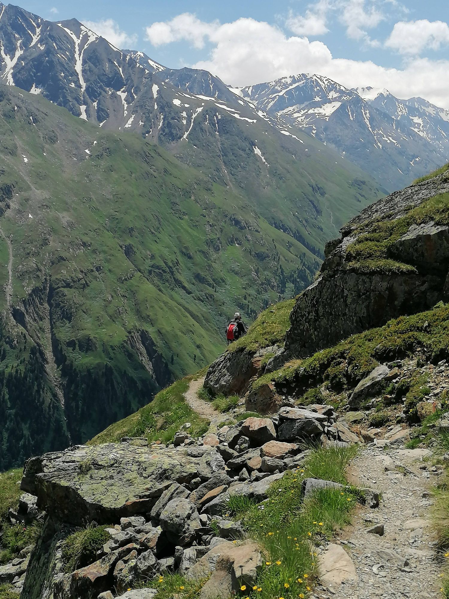
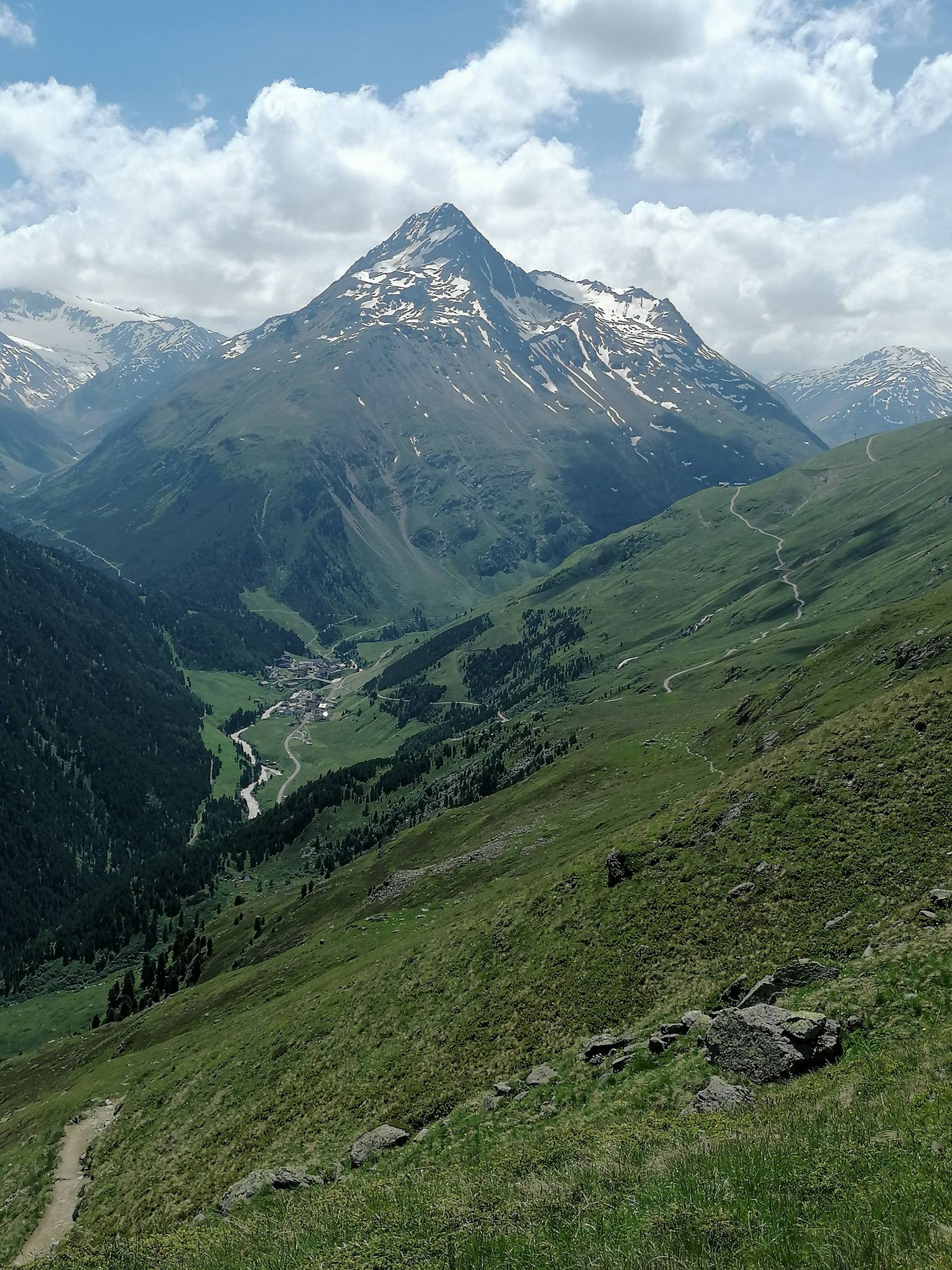
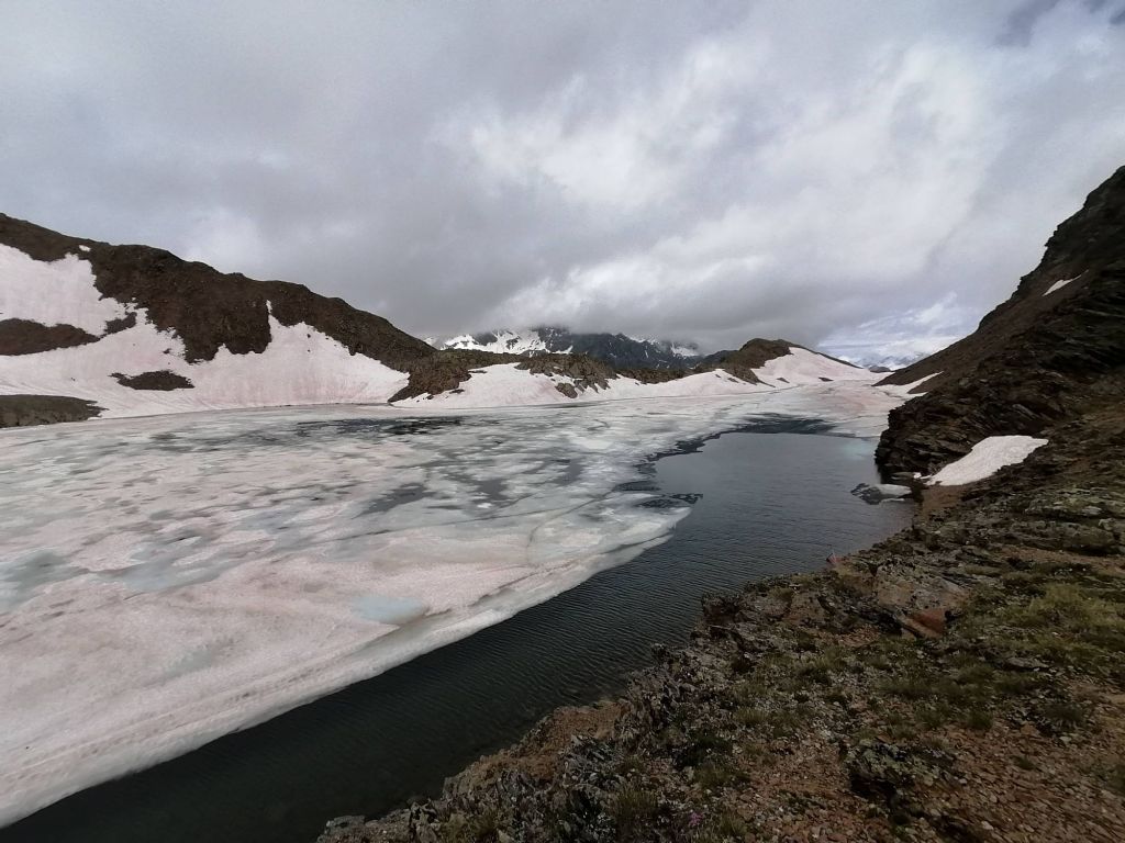
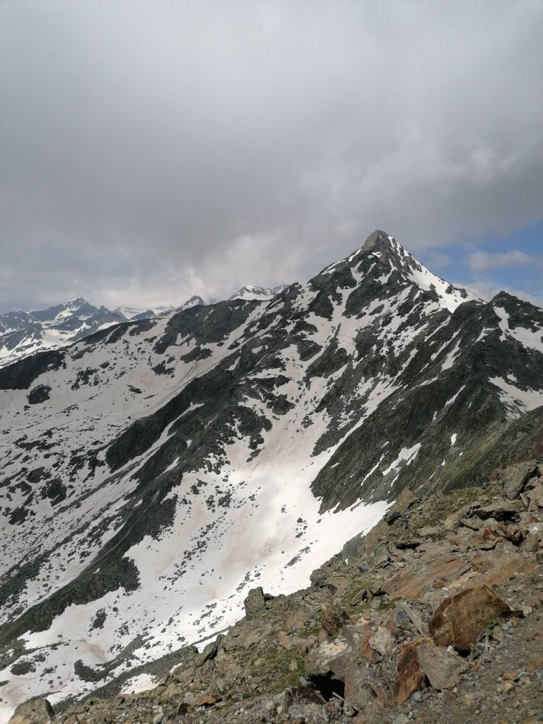
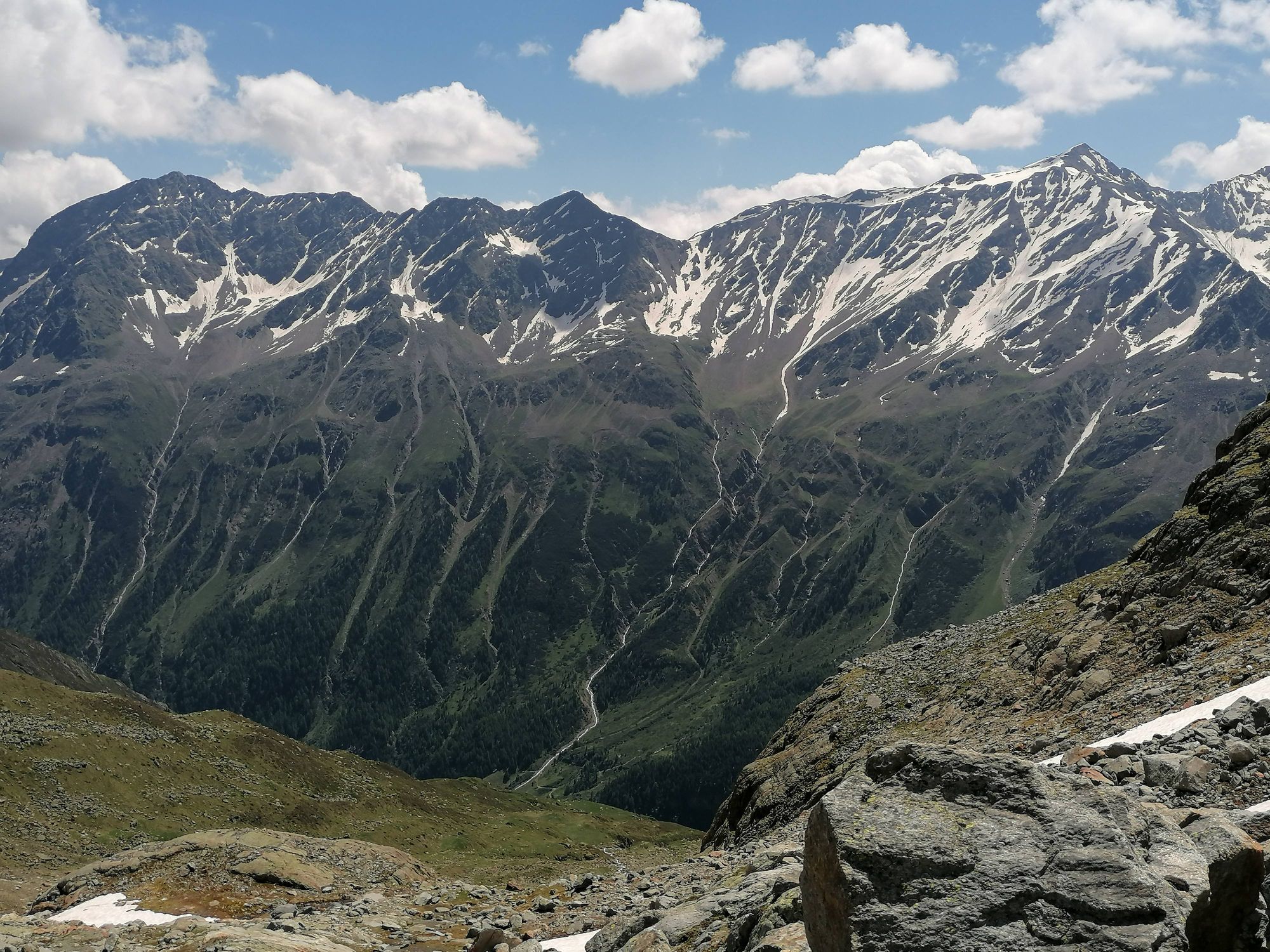
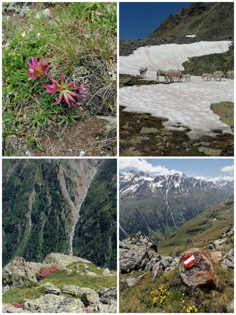
The walk was beautiful, varied, mostly staying between 2800-2500 m.  While not difficult, it required attention as we had to cross fields of snow and of stones, where a false step could have serious consequences.  We really enjoyed the scenery.

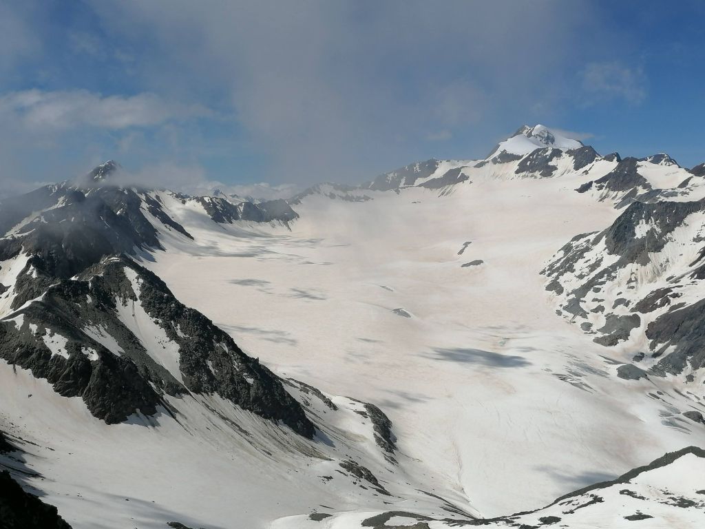
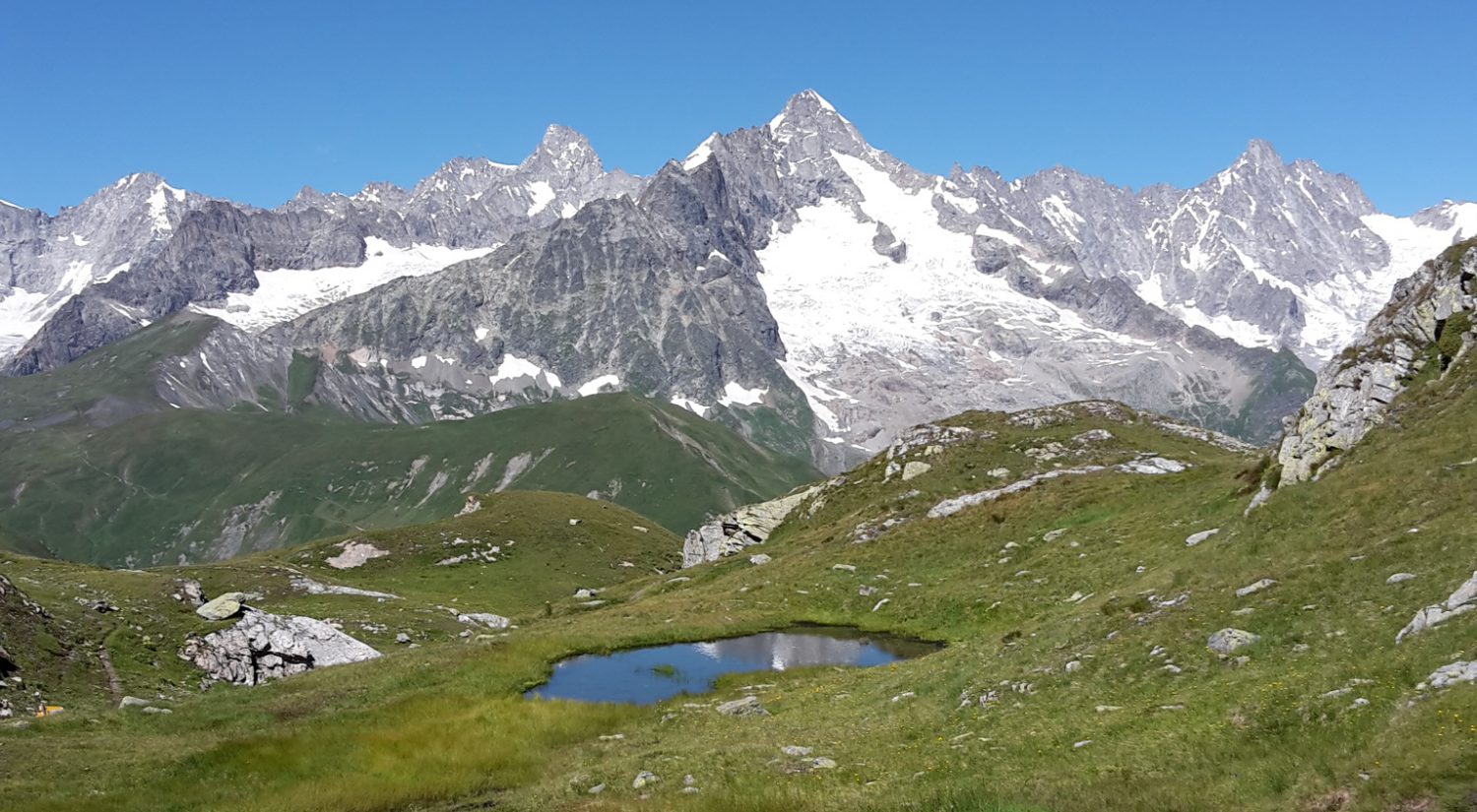
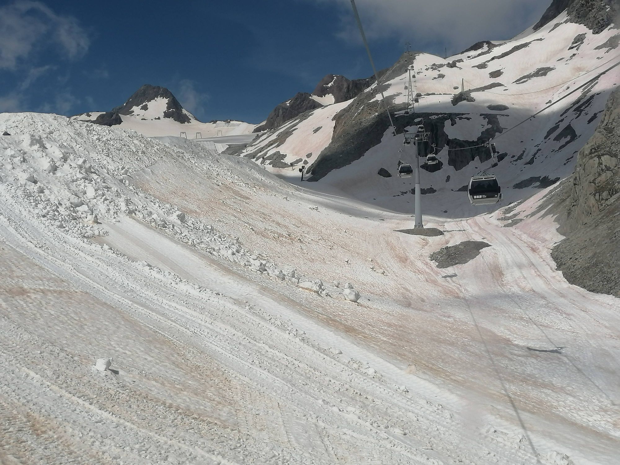
Before starting on the walk, we took a gondola that took us to a viewpoint where we could see several glaciers, many 3000m+ summits, including Wildspitze, Tirol’s tallest mountain at 3768 m.

A flanc de montagne

Avec une journée ensoleillée annoncée, nous avons pris le bus d’une durée de 30 minutes pour le glacier de Tiefenbach afin de pouvoir marcher de là jusqu’à Vent, le dernier village de la vallée, à environ 3h45.  Pour atteindre ce glacier, le bus passe par le plus haut tunnel routier d’Europe, curieusement nommé Rosi-Mittermaier-Tunnel, l’une des plus grandes skieuses des années 1970 et citoyenne allemande.  Sa rivale d’alors était une Autrichienne, Annemarie (Moser-)Pröll, une grande championne, et j’aurais donc pensé que le tunnel porterait plutôt le nom de la star nationale.

La marche était belle, variée, restant le plus souvent entre 2800-2500 m. Sans être difficile, elle demandait de l’attention car nous devions traverser des champs de neige et de pierres, où un faux pas pouvait avoir de graves conséquences.  Nous avons beaucoup apprécié le paysage.

Avant de commencer la marche, nous avons pris une télécabine qui nous a emmenés à un point de vue d’où nous pouvions voir plusieurs glaciers, de nombreux sommets de plus de 3000 m, dont le Wildspitze, la plus haute montagne du Tyrol à 3768 m.

Schwarzsee, Sölden

The sun reappeared in the village at around noon, so we planned a shorter hike. Again, we took a bus and a gondola to get well above the tree line.  Starting at around 2500m, it was going to be a 30-minute walk up to Schwarzsee. The idea was then to go on further up to the summit at 3200m before coming back down and another hour across meadows.

At the lake, though, clouds were still present and the wind was getting stronger, bringing more clouds in.  The lake, at 2800m was almost entirely covered with ice.  It was a more popular hike because of  its easy accessibility.  Another (half) day of beautifuil scenery.

Le soleil est réapparu dans le village vers midi, nous avons donc prévu une randonnée plus courte. Encore une fois, nous avons pris un bus et un télésiège pour arriver au-dessus de la limite des arbres. À partir d’environ 2500 m, il devait y avoir une marche de 30 minutes jusqu’au Schwarzsee. L’idée était ensuite de continuer jusqu’au sommet à 3200m avant de redescendre et de passer une heure à travers les prairies.

En haut, cependant, les nuages étaient toujours présents et le vent devenait plus fort, en apportant du brouillard. Le lac, à 2800m, était presque entièrement recouvert de glace. Cette randonnée était plus populaire en raison de sa facilité d’accès. Une autre (demi-)journée de paysages magnifiques.

A few days rest in Tirol

It has been a challenging year and we have felt the need for a few days rest in Austria.

We are in Sölden, a resort known for launching the European ski season  competitions in October/November and for one of the Daniel Craig-era James Bond setting. 

We are of course hiking a bit while here but have access to saunas and steam baths when we get back, a real luxury.

The area has also had a challenging spring, weather-wise but has not suffered the floods and landslides that have plagued the French, Swiss and Italian alps.  This is the reason why our hiking has been so limited this year.

We started easily with a gondola ride to 3000 m.  We then went down to Gaislachersee at 2700 m, which looks heart-shaped from above.  Blocks of ice were still floating on it, a sign of a cool spring but this did not stop John from a quick dip. All-in-all a 3 hour walk and a good start to this short holiday. Rain and strong winds were forecast for the next day.

Quelques jours de repos au Tyrol

Cela a été une année difficile et nous avons ressenti le besoin de quelques jours de repos en Autriche.

Nous sommes à Sölden, une station connue pour le lancement des compétitions de la saison européenne de ski en octobre/novembre et pour l’un des décors de James Bond de l’ère Daniel Craig.

Nous randonnons bien sûr un peu ici mais avons accès aux saunas et hammams au retour, un vrai luxe.

La région a également connu un printemps difficile, du point de vue météorologique, mais n’a pas subi les inondations et les glissements de terrain qui ont frappé les Alpes françaises, suisses et italiennes. C’est la raison pour laquelle nos randonnées ont été si limitées cette année.

Nous avons commencé facilement par une ascension en remontées mécaniques à 3000 m. Nous sommes ensuite descendus jusqu’au Gaislachersee à 2700 m, qui ressemble à un cœur vu d’en haut. Des blocs de glace y flottaient encore, signe d’un printemps frais, mais cela n’empêcha pas John de s’y baigner. Au total, 3 heures de marche et un bon début pour ces courtes vacances. De la pluie et des vents violents étaient annoncés pour le lendemain.

Berliner Höhenweg day six: Griezer Hütte to Kasseler Hütte

This was a reasonable pass, followed by a hike around the edge of the next valley, at about 2,000m.  The path was okay, though steep and narrow in parts, so you needed to pay attention because of the rain. 

Again, my camera was in my bag to stay dry.

Again, this hut was built by the Griezer section of the German Alpine Club.

That evening the person responsible for the hut told us that the weather forecast for the next day was bad; that the usual nine-hours hike would probably take eleven hours; that the path would be slippery and dangerous; and that nobody should hike it alone. 

The next morning, we all decided to go down to the valley.

Along the way I have made some new friends, who all showed patience with my poor German.


Berliner Höhenweg day five: Berliner Hütte to Griezer Hütte

This was the toughest day.  Threatening weather meant an early start.  The climb to the pass was not too demanding, but we passed the beautiful, mirror-like Schwarz See.

The black clouds beyond the pass meant we should not wait at the top.  So I started my descent down the cliff face holding the cable. 

The rain started.

It was a steeper via ferrate than the previous day.  The rain made the cable cold and wet, and my fingers started to get numb.  I was scared.

My new-found friends, two families with four teenage girls, found it a giggle. 

So what a wimp am I? 

This hut was built by the Griezer section of the German Alpine Club.  A man working there played accordion in the evening.


Berliner Höhenweg day four: Furtschaglhaus to Berliner Hütte

This hike crosses a saddle.  From the saddle it is a short climb to the peak, the Schönbichler Horns at 3,134 m.  I left my pack at the saddle and climbed to the peak.

The view over the surrounding alps is beautiful as you are above most of the surrounding peaks.

The descent is somewhat tricky, and I learnt what “via ferrate” is in German: “Klettersteig”.

The Berliner Hütte was built by the Berlin section of the German Alpine Club in 1879 and is grandiose.  Early photos show it at the edge of a glacier, which is no longer there.


Berliner Höhenweg day two: Gamshütte to Friesenberghaus

This was to be a long nine hours hike, and the forecast was for storms in the afternoon.  Based on my first-day pace, I anticipated hiking ten hours.  Everyone left early.

All morning I walked through cloud and did not take my camera out.  The storms arrived and the rain and wind were cold.  During a break in the rain I put on my warmest clothes.

I use a stop-watch to keep track of time.  At seven hours hiking, expecting ten hours total, with the weather turning cold, wet and windy, I started looking for possible spots to shelter.  However there are few flat spots and it is all boulders and rocks.  Putting up a tent was not possible.

What a relief to see a sign indicating the hut was 30 minutes ahead.  I walked it in 8 1/4 hours.

I was put in one of the “winter” shelters.  These are left unlocked all winter for hikers and skiers.  There I met a young man from Colorado who is studying biology and thinking of becoming a vet.  Two days earlier I had been chatting with a young man from Ohio who is studying biology and thinking of becoming a vet.  The contrast between the two men was stark.


The Berliner Höhenweg, day one: Finkenberg to Gamshütte

On the train connecting the two paths, I chatted with a woman who spoke to me of the importance of ketones, the benefits of coconut oil and several other aspects of diet.  She was trim, healthy and 80.  I was surprised as I have been discovering these things over the past year; she is years ahead of me.  I was pleased to able to have such a conversation in German.

Leaving Finkenberg, you pass an old wooden bridge.  I also saw an old racing car someone had hauled from the Netherlands

The first day is an easy, though steep, three hours up to the Gämshütte.  I had been been keeping good time on the Adlerweg, but decided to go somewhat slower pace.  On the way about a dozen people all passed me in a hurry to get there.

The atmosphere was friendly and welcoming, more what I had been looking for.  The showers were outside with a stunning view and cold water.  (thanks Saval for introducing me to Wim)

I was glad to be above the tree-line.


Adlerweg day three: Hintersteiner See to Buchacker Inn

This day I was planning on combining two days, but that would have made nine hours hiking, with a steep ascent in the middle.  So I skipped the first day, and went to Kufstein, a pretty little village. 

A short train ride took me to me to the beginning of the walk.  The start was a pleasant ascent through forest where someone has installed a chair and water fountain.

Then the hike continued along the edge of cliffs over-looking the Inn valley.  The highest point of the day was at Hundsalmjoch Col, 1,637 m.

At the end I realised this was not the hike I was expecting and decided to change paths to the Berliner Höhenweg the next day.

John