A slice of potica before the walk

Sunday morning we left Slovenj Gradec and decided to hitch the first 6km, as they were along a road (also saving us 400m on a 1400m altitude gain).
The person who picked us up was an older priest on his way to give mass in a small church up the valley. He was going to make a detour to a farm to give communion to a very old lady who is home-bound, living with her children.
We went along with him and, while waiting in the farm yard, were offered slices of delicious home-made potica. One of Slovenia’s national dishes, it gained some foreign fame when Pope Francis asked Melania Trump if she prepares it for her husband.
After this, we hiked for about 8 hours.


Une tranche de potica avant de marcher

Dimanche matin, nous avons quitté Slovenj Gradec et décidé de faire du stop pour éviter de marcher 6km le long de la route (et gagner 400m sur les 1400m de montée).
La personne qui nous a emmené était un vieux curé se rendant dans une église de montagne pour y donner une messe. Auparavant, il allait s’arrêter dans une ferme pour donner la communion a une vieille dame invalide qui y vit avec sa famille.
Alors que nous l’attendions dans la cour, on nous a offert de délicieuses tranches de potica faite maison. L’un des plats emblématiques de la Slovénie, la potica s’est fait connaître récemment à l’étranger quand le pape François a demandé à Melania Trump si elle en préparait pour son mari.
Nous avons ensuite marché 8 heures.

Leaving Maribor

The first three days stay around the 1,000-1,500m range and take us mostly through forests.
We started under menacing skies and stopped at a cabin just as the fog and rain rolled in and woke up to a clear blue sky.
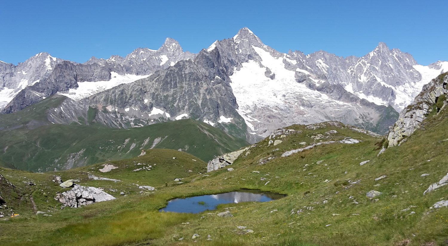
It is really on the third day that we got out of the forest and we had sweeping views, all the way to the mountain ranges we are due to hike. Part of the area is a swampy high plateau, covered with low pines, as seen from an observation tower.


Les trois premiers jours passent dans des forêts entre 1000 et 1500m.
Nous avons commencé sous un ciel menaçant et nous sommes arrêtés dans une cabane quand le brouillard et la pluie sont arrivés. Le ciel était bleu le lendemain matin.
Ce n’est que le troisième jour que nous sommes sortis des bois et avons pu profiter de vues dégagées sur les chaînes montagneuses que nous aurons à franchir. Une région traversée était un haut plateau de marécages, recouvert de pins, vu du haut d’une tour d’observation.

Change of plan

We are in Slovenia. The original plan was to hike the Via Dinarica, so we stayed at Postojna’s youth hostel and hiked to Predjama Castle, km0 of the trail.

Instead, we will start our summer hike with the Slovenian Mountain Trail, about 600 km from Maribor to the Adriatic.

Nous sommes en Slovénie. Le plan initial était de faire la Via Dinarica; nous avons dormi à l’auberge de jeunesse de Postojna et sommes allés à pied au château de Predjama, km0 du parcours.

Changement de plan : nous allons parcourir le Sentier des Montagnes slovènes qui relie Maribor à la côte adriatique en 600km.

Anaga mountains

Another grey and rainy day today but we went on a spectacular hike in the Anaga mountains, from Taganana to Tamadite beach and back. The walk itself was simple but the scenery was gorgeous.
Although the area was difficult to access, it was settled very early on and there are vineyards perched on the slopes. Most of the wine is kept for family consumption, the rest being sold in the small local bars.

Encore un jour gris et pluvieux mais nous avons fait une randonnée spectaculaire dans les montagnes d’Anaga, de Taganana à la plage de Tamadite et retour. Le parcours était simple mais beau.
Bien que la région ait été difficile d’accès, elle a vite été habitée et il y a de petits vignobles sur les pentes escarpées. La plus grande partie de la production vinicole reste dans les familles mais une portion est vendue dans les cafés du coin.

First hike in Tenerife

A first 20km hike through different terrains, with views of Pico del Teide, Spain’s tallest mountain at 3,718m.
We started at 1200m in surprisingly cold temperatures (steam coming out of our mouths) and we regretted not bringing our gloves.
The forest was very humid, adding to the feeling of cold, and the clouds moved in at 11am.

Une première randonnée de 20km à travers des paysages et terrains variés avec des vues du Pico del Teide, sommet le plus élevé d’Espagne, à 3718m.
Nous avons commencé à 1200m dans des températures plus froides qu’attendues (buée lorsque nous parlions) et nous avons regretté de ne pas avoir amené nos gants.
La forêt était très humide et ajoutait à la sensation de froid ef les nuages sont arrivés à 11 heures déjà.

Deià to Sóller Walk

Another fine walk, from the lovely village of Deià to Soller. We walked through olive, lemon and orange groves, with seaviews, on an ancient path, built by the Arabs in the 10th century.

Encore une belle randonnée depuis le charmant village perché de Deià à Soller. Nous avons marché parmi les oliviers, citronniers et orangers, avec vue sur la mer, sur l’ancien chemin créé par les Arabes au 10e siècle.