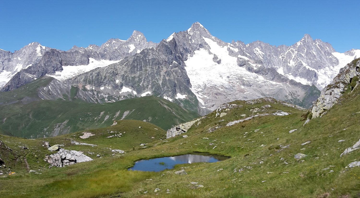
The west coast of Mallorca offers some beautiful hikes.
Our first day was pleasant : 4 hours stopover in Bordeaux with a delicious three-course lunch at Papy fait de la résistance, we stayed reasonable on the wine and napped on the train to Irun. Met Canadians and Australians on the St-Jacques path. We walked to Cabo de Higuer, dipped our toes in the ocean and could see the Pyrenees which will take us all the way to the Mediterranean. Tapas and wine in Irun at 10 pm. Our first test today : about 15 km, under the sun, first night in the tent and heavier backpacks than we would have hoped for. Unlikely to be able to post before the week-end. Notre premier projet : le GR11 Notre première journée a été facile : 4 heures de pause à Bordeaux avec un délicieux déjeuner (entrée, plat et dessert) chez Papy fait de la résistance. Train pour Irun (petite sieste digestive), beaucoup de personnes voyageant sac au dos et faisant le chemin de St-Jacques. Belle soirée jusqu’au Cabo de Higuer avec trempette rapide dans l’Atlantique et vue des Pyrénées, puis tapas et vin à Irun. Premier test aujourd’hui avec 15 km, env. 4h30-5 heures de marche (sous le soleil), première nuit dans la tente et pas de post avant le week-end… Our first day was pretty tough : 18 km, 10 kg on the back and 30°C. We slept in our tent, our first camping since 1995 ! The second day was easier: we are getting used to the load. We found a quiet spot to camp. We had to take a long pause in the middle of the day because of the heat (up to 34). Mad dogs and Englishmen… Chiens fous et Anglais… La première journée fut rude : 18 km, des sacs de 10 kg sur le dos et plus de 30°C. Nous avons dormi dans notre tente pour ce qui était notre première nuit de camping depuis 1995 ! La deuxième journée fut plus facile : nous nous habituons au poids. Nous avons trouvé un coin tranquille pour camper après avoir fait une longue pause dans la forêt dans la journée à cause de la chaleur (34°C). Les Australiens utilisent cette expression “Seuls les chiens fous et les Anglais sortent au soleil de midi”. After a good night’s sleep we woke to cooler weather: 22 instead of 32°C, it makes it much easier. The start was a climb through beautiful misty forests. At the top we saw people shearing sheep. They were really friendly, welcoming and happy to show us their work. Lunch was a picnic at a cabin, simple but sustaining. Another down and up and we arrived at a superb spot at the top of a ridge and camped for the night. Rencontre avec des bergers Après une bonne nuit de sommeil, nous nous sommes réveillés dans des températures beaucoup plus fraîches, qui nous facilitent la tâche. La première montée s’est faite dans une forêt humide et dans le brouillard. Au sommet, nous avons assisté à la tonte des moutons. Une autre descente et remontée et un coin superbe où mettre la tente. With the heat wave (forecast 34 C) we had breakfast at 5:30 and started walking at 6:15. Climbing through misty forests, walking in 20 C was pleasant and we made good progress. At the top we watched the mist lift from the valleys. We got to the last leg of the stage as the temperature soared to 34 C. Staying in a wonderful Casa Rural where Anabel is very welcoming. Tomorrow is going to reach 39 C so we are planning a 5:30 am start, as there is no forest (and shade ) for the first 4.5 hours. Belle brume Avec la vague de chaleur, nous nous sommes levés à 5.30 et sommes partis à 6.15. La montée dans les bois était superbe, accompagnés par le chant des oiseaux. Demain, il est prévu 39°C et nous partirons à 5:30. Les 4 premières heures n’offrent en effet aucune ombre. Stunning views and stinging nettles, which to watch? That was the dilemma of our second hour of walking today. We started walking about 6:00, a bit later than planned. We finished well before the heat got bad, so our timing was good. Walking along cliff tops there was a good breeze that kept us cool. The views were great. We came across an abandoned building and could not resist filming the opening scene of Silverado. In a little while we will go swimming in the river by the camping. Vue ou orties, que choisir ? Nous avons eu un peu des deux. Bain dans une piscine naturelle sous peu. This boots are made for walking, but not in 38°C heat, day after day and John’s blisters took a turn for the worse. So, change of plan: since we need to stop for several days, we have decided to come back to Anabel’s house. Access to a kitchen, clothes washing and a house that stays cool in the heat convinced us it was the best possible move. Tiny hamlet but fishmonger comes tomorrow. Anabel is warm and friendly & we are happy to spend the next few days here. Ces bottes sont faites pour marcher, mais pas pendant des jours à 38°C; les cloques de John ont empiré. Donc, changement de plan: nous avons décidé de revenir en arrière de 2 jours. Le hameau n’a pas de commerces mais le poissonnier et le maraîcher viennent demain. Anabel est très chaleureuse et amoureuse de sa vallée et de sa culture basque. Un parfait endroit pour se ressourcer. A quiet day in the countryside… The whole village gathers when the fishmonger drives in and blows his horn, and catches up on the news. Une journée tranquille à la campagne.. J’ai acheté du poisson et des légumes afin de profier de l’accès à une cuisine et pouvoir changer du menu habituel de salami et fromage et de la viande omniprésente sur les cartes des restaurants locaux. The Pic du Midi, as seen from Ibon d’Anayet. Although not the highest summit of the Pyrénées, it is the most iconic, just like the Matterhorn is for the Alps. We went over the 2000 m for the first time yesterday. Having started at 1400 m, it was warm but did not go above 31 degrees, which seemed cool compared to the previous 2 weeks. Springs and waterfalls where we could refill our water bottles, Alpine flowers and a 2-hour long picnic at the lake (2264 m) to arrive in the pretty village of Sallent de Gallégo : a very pleasant day. Le Pic du Midi de l’autre côté du lac Le Pic du Midi, tel qu’il se voit depuis le lac d’Anayet. Ce sommet, qui n’est pas le plus élevé des Pyrénées, est une icône, comme le Cervin l’est dans les Alpes. Journée magnifique en montagne.. Nous avons passé la barre des 2000 m pour la 1ère fois. Début à 1400 m, donc températures agréables ne dépassant pas les 31 degrés, rafraîchissant après les 2 dernières semaines. Sources, cascades où nous avons pu remplir nos bouteilles, fleurs alpines et un pique-nique de 2 heures au lac avant d’arriver dans le charmant village de Sallent de Gallégo : une très belle journée ! On Friday, we left the lovely village of Sallent de Gallego, the only place we found with a good bakery and good ice-cream. The walk to the refuge was easy and it only took under 4 hours to reach it. We got up early to climb what was considered one of the toughest passes. It took a long time to climb one hundred metres, as it was very slippery: stones, earth, nothing held. We walked all day with our GR11 friends, Chloé, Ariel, Sabine & Saval. We stayed at Casa de Piedra refuge, good nourishing food, great Basque company. We walked through Canyon de Ordesa national park to reach the packed refuge of Goriz, (90 sleeping & 10s of tents), 2 cold showers and 4 toilets, the gang was still together. That cabin is particularly popular as it is the starting point to climb Monte Perdido. Nouveaux amis Vendredi nous avons quitté le joli village de Sallent de Gallego, seul endroit où nous avons trouvé une très bonne boulangerie et des glaces maison. Debout à l’aube pour monter à l’un des plus difficiles cols. cela nous a pris longtemps pour faire une centaine de mètres, la terre, les pierres, rien ne tenait. Nous avons marché toute la journée avec nos amis du GR: Chloé, Ariel, Sabine et Saval. Refuge Casa de piedra, bonne nourriture consistante, et excellente compagnie basque. Entrée dans le parc national du Canyon d’Ordesa. Montée au refuge bondé de Goriz (90 places et dizaines de tentes, 2 douches froides et 4 WC). Ce refuge est le point de départ pour atteindre le sommet du Mont Perdu. We left Goriz for a tough day : the start was pleasant, beautiful views, uphill, we then went through a (retrospectively) hair-raising descent on huge limestone slabs, fine at the time but scary when looking back… Then came a long, steep 1000 m drop. Nous avons quitté Goriz pour une dure journée. Le début s’est bien passé, vues magnifiques, montée. Puis une descente sur d’immenses plaques de calcaire, beaucoup d’attention mais pas de problème, frayeur rétrospective quand nous avons vu où nous étions passés… Ensuite descente rude, raide et abrupte. Last stages to reach Catalunya A un peu plus de la moitié Dernières étapes avant d’atteindre la Catalogne. Nous avons dépassé la moitié du parcours. In Catalunya, we are entering the lakes region, taking our time going through the national park of Aigüestortes. There is a run, every September, called “chariots of fire” where the contestants have to go to 9 refuges that are in the park. This race has attracted a lot of attention to the park and there are now tours, at other seasons, with people walking from refuge to refuge (all packed), anything from 2 to 9 days (4 to 5 hours walk daily). Most of the people walking along the path of the Chariots are not regular hikers but saw the race on television and want to have their share of this wonderful mountain area. Les chariots de feu En Catalogne, nous entrons dans la région connue pour ses lacs. Nous prenons notte temps pour traverser le parc national d’Aiguestortes. Chaque année en septembre, il y a une course qui s’appelle “les chariots de feu”, les concurrents doivent rejoindre 9 refuges disséminés dans le parc. Cette course a attiré beaucoup d’attention sur le parc et les refuges sont pleins; les vacanciers passent de 2 à 9 jours de refuge en refuge (journée de 4 à 5 h de marche). La plupart de ces personnes ne connaissent pas la montagne mais y ont été attirées par les émissions télévisées montrant le parcours. After taking the time to walk quietly through the national park, we left the refuge early in the morning and stopped for a breakfast along the Estany de Sant Maurici. We went further down to Espot and had a second breakfast with Tasha & Chloé. We met again the next day at an unmanned refuge. A group of scouts joined us and the 15 of us slept in the 9-bunk beds refuge… Des scouts.. Après avoir pris le temps de visiter tranquillement le parc national, nous avons quitté le refuge à l’aube et déjeuné au bord du lac Estany de Sant Maurici. Nous avons pris un 2e déjeuner à Espot en compagnie de Tasha et Chloé. Nous nous sommes retrouvés le lendemain dans un refuge non gardé où un groupe de scouts nous a rejoints. Nous avons dormi à 15 dans le refuge équipé de neuf matelas…. Early rise again for a tough day’s walk. We decided to take an alternative route to the official GR11 and had to make our own path through slippery scree and boulderfields. The reward, after 2 hours, was the view of the only lake we’ve seen with ice on it. The pass being at 2750 m, we were not particularly high. The summit was the border with Andorra. .. et traversée d’Andorre Départ très matinal pour une longue et dure journée de marche. Nous avions choisi de prendre une alternative au GR11 et avons dû créer notre propre chemin parmi les petites pierres glissantes et les éboulis. La récompense, après 2 h, fut la vue plongeante sur le seul lac encore partiellement recouvert de glace. Le col marque la frontière avec l’Andorre. Longue descente sur la station de ski sans âme d’Arinsal, que nous avons vite quittée pour une longue montée et descente dans la vallée suivante. Un dernier effort de 45 min. de montée avant de trouver un joli coin où poser notre tente. Une heure plus tard, Chloé et Tasha nous rejoignaient pour une sympathique soirée. Two days ago was a long climb up a valley that was nice. Over the pass we camped in a discrete spot at 2600m. The sunrise was really beautiful. Yesterday was longer and harder. We arrived early at a refuge but decided to continue to Puigcerdà. Arriving at 3:30 pm everything was shut. We found nice accommodation and later when everything opened we found nice shops, fresh fruit and vegetables. Only two photos, both signposts. One is just before the pass, and the other shows how far we have left to the end of the hike. Chloé is leaving the GR11 and taking the train to Barcelona. We have spent 3 weeks together on and off. Encore 233 km Avant-hier, nous avons remonté une vallée très plaisante. Après avoir dépassé le col ( et quitté Andorre), nous avons campé sur un promontoire et profité d’un beau lever de soleil. Hier, le trajet nous a paru long et difficile. Nous sommes arrivés tôt à un refuge et avons décidé de continuer sur Puigcerda. Arriver à 3.30 dans une ville en Espagne est déprimant : tout est fermé (même les pensions et petits hotels). Nous avons finalement trouvé un petit hotel agréable et pu acheter des fruits et légumes très frais. Après un mois de petits villages, cette petite ville nous semble énorme. Deux photos, l’ une juste avant le col, en Andorre et l’autre indiquant le nombre de kilomètres qu’il nous reste à parcourir. Chloé quitte le GR11 et prend le train pour Barcelone. Cela fait près de 3 semaines que nous nous sommes rencontrés, We walked up the valley of Nuria under menacing skies. The day before we had arrived at the camping in Planoles just in time to put up our tent before torrential rains and a fun evening in the camping restaurant. Nuria was cold. We woke freezing, wearing our thermal underwear and balaclava. We walked wearing everything until the sun reached us. Then it was shorts and light shirt again. Here we were at the highest (2800 m) point on the trek, a long way east from the higher mountains. Within 24 hours, we dropped down to 200 m altitude ! We wild camped with Tasha along the way and had to fight off a hungry fox. Nous avons remonté la vallée de Nuria sous des nuages menaçants. Un jour plus tôt, nous étions arrivés au camping de Planoles juste à temps pour monter notre tente avant que des pluies diluviennes ne s’abattent sur la région; nous avons passé la soirée en bonne compagnie au restaurant du camping. Il faisait très froid à Nuria. Nous nous sommes réveillés, gelés, ayant enfilé nos sous-vêtements thermiques et passe-montagnes. Nous avons porté nos habits chauds jusqu’à ce que le soleil nous atteigne puis nous avons à nouveau pu porter des shorts et chemises légères. Nous sommes arrivés au point le plus élevé du parcours, à 2800m, loin à l’est des montagnes les plus hautes. En 24 heures, nous sommes descendus à une altitude de 200m. La chaleur est humide maintenant et le chemin suit désormais des routes de campagne peu ombragées. Les sources d’eau ne sont pas assurées, il y a eu de nombreux incendies de forêts, ce sera un gros défi pour la fin du voyage. We made it lighthouse to lighthouse, Atlantic to Mediterranean, 800 km, 45,000m up and 45,000m down. We finished the GR11. Our arrival at Cap de Creus after a long, hot day. Cap de Creus, fin du parcours Nous l’avons fait : du phare de Cabo de Higher au phare du Cap de Creus, de l’Atlantique à la Méditerranée, environ 800 km et 45.000m de montée et 45.000m de descente. Nous avons fini le GR11. Notre arrivée après une longue journée de marche sous une chaleur écrasante. On our way to our next hike, we had to stop in Bologna, one of our favourite cities in Italy, arguably the best gelato town and many good memories. En route pour notre prochaine randonnée, nous devions absolument faire un arrêt à Bologne, l’une de nos villes italiennes préférées, la ville des meilleures gelati et où nous avions de bons souvenirs de séjours précédents. So Trenitalia tried to conspire to keep us eating gelati in Bologna. We wanted the train leaving platform 6 and learnt we were on 6 West, not 6. We ran (with backpacks) and arrived just in time to see the train leave. But it ended well. They refunded our tickets and gave us new ones for an hour later. It happens a lot. Now we are in Sansepolcro, birthplace of Piero della Francesca. We realised we forgot to buy gas for our brand new cooker, so spent time visiting the most elegant hardware stores here. Tomorrow we get the early bus to the trailhead (nobody seems to know it exists). Promise. And start walking. Good news: the bus from Sansepolcro to the start of the trail exists (only twice a week): we took it on Friday morning & started on our walk. After a first day climbing small mountains, the track makes a 3-day detour and follows St Francis’ path through the gentle & peaceful hills of Tuscany. Walking through chestnut trees forests to pass by monasteries perched on hillsides & arrive in small historical villages (for ex. Michelangelo’s birthplace) to eat tasty & fresh food make this trek most pleasant. We are glad, however to have bought insect nets to cover our faces; we would have gone crazy without them. Trenitalia a essayé de nous garder à Bologne pour que nous puissions continuer à y manger des glaces. Nous voulions le quai 6 mais avons appris que nous étions sur le quai 6 Ovest; nous avons couru – avec nos sacs – juste pour voir le train nous filer sous le nez… Tout est bien qui finit bien : Trenitalia a échangé nos billets en riant : apparemment cela arrive souvent. Nous sommes maintenant à Sansepolcro, lieu de naissance de Piero Della Francesca. Nous nous sommes aperçus que nous avions oublié d’acheter une bonbonne de gaz (interdite dans l’avion). Nous avons donc fait le tour des supermarchés et quincailleries du coin. Demain nous espérons prendre le bus (personne ici ne semble connaître son existence) pour le début du sentier. Et nous commencerons à marcher. Promis. Bonne nouvelle : le bus de Sansepolcro au début du sentier existe bel et bien (deux fois par semaine) : nous l’avons pris vendredi matin et commencé notre marche. Après une première journée de petites montagnes, le sentier fait un détour de 3 jours sur le chemin de St François d’Assise à travers les paisibles collines de Toscane. Des marches à travers des forêts de châtaigniers pour passer près de monastères accrochés aux collines et arriver dans de petits villages historiques (dont le village qui a vu naître Michel-Ange) rendent ce voyage très agréable. La nourriture est faite de produits frais et goûteux. Nous sommes contents d’avoir investi dans des filets anti-insectes; nous serions devenus fous sans cela. We are staying in Chiusi della Verna with sisters (nuns), very big house with garden, quiet, only 2 nuns with us (one is on holidays), full board, delicious food, we are the only guests. The atmosphere is both peaceful & joyous. We appreciate their kindness While exploring the highlights of the village, we came upon this 1931 ad campaign, a (water) fountain. Nous sommes à Chiusi della Verna chez des soeurs (nonnes) dans une grande maison avec jardin, tranquille, en pension complète (cuisine fraîche et délicieuse). Il n’y a que deux soeurs (dont la Mère supérieure), la troisième étant en vacances et nous sommes les seuls hôtes. Ambiance paisible et joyeuse à la fois. Nous apprécions leur gentillesse. En explorant le village, nous avons vu cette fontaine publicitaire de 1931 (qui distribue de l’eau). We have walked in rain and fog; the weather is still unstable but we have been able to keep going & have arrived at our first Italian refuge, with a surprising chandelier – and a warm grappa welcome ! Nous avons marché sous la pluie et dans le brouillard. Le temps est encore instable mais nous avons pu avancer. Nous sommes arrivés à notre premier refuge italien (au lustre surprenant dans le décor rustique). Our walk through forests along ridges has been beautiful. We spent one night in a cabin, an unmanned refuge. We made a fire in the evening and for breakfast. The weather has turned much cooler so the fire was welcome. Yesterday was another good hike of about 7 hours. Nos randonnées dans les forêts, le long des crêtes ont été très belles. Nous avons dormi dans une cabane, John a fait du feu soir et matin. Avec les températures très fraîches, très apprécié. Encore une longue journée de 7 heures de marche hier. Leaving Pracchia, we are entering the more alpine part of the Apennines, with stunning views. En quittant Pracchia, nous entrons en territoire plus “alpin” et sommes arrivés sur les crêtes avec des paysages magnifiques. Leaving the warmth of the fireplace in the refuge at Lago Scaffaiolo we continued hiking on the crests. It was so beautiful we were slow as we took lots of photos. The weather has turned cold (3 degrees in the morning, heavy rain) and the refuges are closing down (except Citta de Forlì which is open all year). We had already encountered some difficulties re-supplying as shops or restaurants had closed for their annual leave. So, we took a train to Milan & flew to Malaga. Une journée sur les crêtes Nous avons quitté la chaleur de la cheminée du refuge de Lago Scaffaiolo pour une nouvelle belle journée sur les crêtes. La beauté des paysages nous a ralenti et nous avons pris beaucoup de photos. We spent a couple of days in Tarifa, on the Gibraltar Strait, Morocco is just across. On the photo looking at the town, the Mediterranean is on the right and the Atlantic is on the left. It is a major kite surfing spot and attracts a lot of young people. It has Europe’s largest wind farm. The GR7 started with a 6 km walk along the Atlantic beach, we took our shoes off after a while.. We stopped at the camping at the end of the beach & had dinner right on the shore. Nous avons passé deux Jours à Tarifa sur le détroit de Gibraltar. Le Maroc est tout proche, de l’autre côté du détroit. Sur la photo, sur la digue, la Méditerranée est à droite et l’ Atlantique à gauche. C’est un grand centre de kite surf qui attire beaucoup de jeunes. La plus grande ferme d’éolienne est dans les environs. Le GR7 a commencé par une marche le long de la plage, côté Atlantique, nous avons très vite enlevé nos chaussures.. Nous nous sommes arrêtés au camping tout su bout de la plage et y avons mangé au bord de l’eau. Sleeping under gum trees, walking through cork trees forests (Spain is the world’s second producer of cork, after Portugal). Here is a sample of some of the scenery we walked through. Paysages du GR7 Dormir sous les eucalyptus, marcher dans les forêts de chêne-liège (l’Espagne est le 2e producteur de liège après le Portugal), voici un échantillon des paysages traversés. Arrived at El Chorro, a village famous in the world of climbers, to find the camping permanently shut, the refuge shut, so what do we do? Someone pointed us to a great B&B, the Olive Branch. So we decided to stay an extra day and hike to the top of the nearest peak, “only” 1191 m but great views. Nous sommes arrivés à El Chorro, un village renommé dans le monde de l’escalade et y avons trouvé le camping et le refuge fermés. On nous a recommandé un b & b très sympathique, the Olive Branch, et nous avons décidé de rester un jour de plus. Nous en avons profité pour escalader la montagne locale la plus haute, seulement 1191m, mais belles vues. The GR7 being mostly on roads, concrete or gravel tracks, we have decided to quit. We were hoping to hike in the Sierra Nevada (with mainland Spain’s highest mountain) but the snow is coming & we are not equipped for it. But we have enjoyed the small towns of Ronda, Antequera and Montejaque. Petites villes andalouses Le GR7 se fait principalement le long de routes, sur des routes bétonnées et de gravier, nous arrêtons donc. Nous voulions faire de vraies randonnées de montagne dans la Sierra Nevada (sommet le plus haut d’Espagne continentale) mais la neige arrive et nous ne sommes pas équipés pour. Nous visitons donc Grenade mais les photos ont été prises à Antequera. We spent a few days in Granada and visited, of course, the wonderful Alhambra. Then on to Sevilla and Cordoba. Nous avons passé quelques jours à Grenade et avons bien sûr visité le magnifique palais de l’Alhambra. Ensuite, train vers Séville et Cordoue. We started hiking the Rota Vicentina, about 120 km along the south-west coast of Portugal, at the lighthouse of Cape St Vincent, the southwestern-most point of continental Portugal. After an overcast first day and rain showers, the sun came out for beautiful coastal views. We camped on a beach and fell asleep to the sound of the surf. An early rise and the beach to ourselves. It really is the “Fishermens’ Trail”. We were surprised to see them fish from the tops of the cliffs. The last two days were walking in sand and on beaches. Nous avons débuté la Rota Vicentina, 120 km le long de la côte sud-ouest du Portugal, au phare du Cabo Saõ Vicente, le point le plus au sud-ouest du Portugal. Après un premier jour nuageux et pluvieux, le soleil est apparu et nous a offert de belles vues sur la côte. Nous nous sommes endormis au son des vagues; réveil sur une plage déserte. C’est vraiment le sentier des pêcheurs. Nous avons été surpris de les voir pêcher depuis les falaises. Les deux derniers jours, nous avons marché dans le sable des dunes et de plages presque désertes. As it was getting too cold to hike in Europe, we are now in Thailand. Our hostel in the old town of Bangkok has chosen an interesting decoration theme : Thai expressions, with simple illustrations. Here are a few samples. Comme il commençait à faire trop froid pour randonner, nous sommes maintenant en Thaïlande. Notre pension dans le vieux Bangkok a choisi une décoration intéressante : des expressions thaïes, illustrées de manière simple. Quelques exemples… We are spending a few days on a fairly un-touristic island, Koh Yao Noi, between popular Phuket and Krabbi. Boat outing, bicycling, swimming, eating and resting in hammocks are on the menu before we move on. Nous passons quelques jours sur une petite île, encore peu développée touristiquement, Koh Yao Noi. Elle se trouve entre les populaires Phuket et Krabbi. Sortie en bateau, tours en vélo, baignades et repos dans des hamacs sont au menu avant la prochaine destination. In Chiang Mai with friends, we have participated in the festivities of Loi Krathong. It takes place in the evenings of the full moon of the 12th month of the Thai lunar calendar (usually in November). Thais launch their floating baskets on a river, canal or pond, making a wish as they do so. A Chiang Mai chez des amis, nous avons participé aux festivités de Loi Krathong. Ce festival a lieu lors de la pleine lune du 12e mois du calendrier lunaire thaï (généralement en novembre). Les Thaïs déposent leurs paniers flottants dans des rivières, canaux ou mares, en faisant un voeu. Giant lanterns rise into the air and gracefully float through the sky. Planes cannot fly for two nights. Des lampions géants sont allumés et lâchés, ils flottent gracieusement dans les airs. Tous les vols sont suspendus durant deux nuits. Walking through the streets of the old town of Chiang Mai on day 2 of Loi Krathong, we saw a lot of young people getting ready for a parade. Dans les rues de la vieille ville de Chiang Mai, au 2e jour de Loi Krathong, nous avons vu beaucoup de jeunes gens se préparer pour un défilé. The parade lasted a couple of hours. Thai regional costumes were worn, as well as a Chinese-theme float. For Japan, it was represented by its distinctive youth culture. Le défilé a duré 2 heures. Les participants portaient des costumes régionaux thaïs et il y avait un char “chinois”. Le Japon était représenté par sa culture jeune, poupées, manga, vaguement gothique. We have left Thailand and have arrived in Georgetown, Penang (Malaysia) after a pleasant 21-hour train ride from Bangkok. Bumpy train tracks but roomy beds. Big thanks to Barrie Collits (+ Bruce, Gerard & Sunee) and Julie Hastings for their warm welcome in Chiang Mai. Nous avons quitté la Thaïlande et sommes arrivés à Georgetown, Penang (Malaisie) après un plaisant voyage en train de 21 heures. Les rails avaient des bosses (!!??), mais les lits étaient larges. Un grand merci à Barrie Collits (+ Bruce, Gerard et Sunee) et Julie Hastings pour leur accueil chaleureux à Chiang Mai. The old town of Penang is on the UNESCO world heritage list and we spent some time meandering through its lovely streets. Impressions of Armenia street… La vieille ville de Penang est sur la liste du patrimoine mondial de l’UNESCO et nous avons pris le temps de déambuler dans ses délicieuses petites rues. Quelques impressions d’Armenia street… Georgetown Details in the stonework of a Chinese temple in Georgetown. Détails des sculptures de pierre d’un temple chinois, Georgetown. And another great day in Penang, when Angela proposed to join her and Hernán for a tour of the island. We visited small fishing villages in the south, walked on an almost empty beach (just people fishing), had a wonderful and tasty lunch, sampled all kinds of food unknown to us, drove through rainforest and orchards. Un tour privé de l’île Encore une belle journée à Penang quand Angela nous a invités à la joindre, avec Hernán, pour un tour de l’île. Today we walked in the national park in the northwestern part of the island of Penang. We went to Turtle beach where there is a turtle sanctuary and hatchery. Aujourd’hui, nous avons maché dans le parc national, au nord-ouest de l’île de Penang. A Turtle Beach, il y a un sanctuaire et une couveuse pour les tortues. Kek Lok Si is the largest Buddhist temple in Southeast Asia; it is spread over the hills surrounding Georgetown. It houses a 7-storey pagoda “of ten thousand Buddhas” and a 30 m bronze Kuan Yin statue. Kek Lok Si est le plus grand temple bouddhiste d’Asie du sud-est. Il contient, entre autres, une pagode “des dix mille Bouddhas” de 7 étages et une statue en bronze de Kuan Yin de plus de 30 m. Jimmy Choo was born in Georgetown, Penang Jimmy Choo est né à Georgetown, Penang Streets of Georgetown, Penang; even run-down houses have charm… Les rues de Georgetown, Penang; même les maisons non retapées ont du charme… We did not want to travel over the busy Christmas period, and we got our first housesit: a cat in North Carlton, Melbourne. We spent some time in Melbourne’s State Library, a beloved landmark of the city. It hosts over 2 million books and has interesting permanent exhibitions, one of which shows Ned Kelly’s armour. Bibliothèque de Melbourne Nous ne voulions pas voyager pendant la très chargée période de Noël et nous avons obtenu notre premier housesit à North Carlton, Melbourne. Nous nous occupons d’une petite chatte, Pepper. Nous avons passé quelques heures dans la bibliothèque de l’état de Victoria à Melbourne. C’est l’un des bâtiments les plus célèbres de la ville. La bibliothèque abrite plus de 2 millions de livres et offre des expositions permanentes intéressantes. L’armure de Ned Kelly, héros malheureux du combat contre l’autorité, y est exposée. Victoria Food Market, Melbourne, the morning before Christmas and we could barely move! Du monde au marché Le marché Victoria à Melbourne, le matin du 24 décembre et nous pouvions à peine bouger. Caught up with Tash in St.Kilda today, whom we had met and spent about two weeks hiking with on the GR11 in Spain. Lots of laughs.. Nous avons retrouvé Tash à St. Kilda aujourd’hui. Nous l’avions rencontrée et marché en sa compagnie pendant deux semaines sur le GR11 en Espagne. Fous rires de rigueur… We started the new year with a road trip down to the Mornington Peninsula. Spent the day between the lovely quiet beaches, with their typical huts and an interesting exhibition about Australia’s beach culture. Nous avons débuté l’année avec un petit voyage dans la Péninsule de Mornington. Nous avons passé la journée entre de jolies plages tranquilles avec leurs cabanes typiques et une intéressante exposition sur la culture de la plage en Australie. We spent a great afternoon cycling the Yarra trail, passing though lovely quiet neighbourhoods and some bush where the only sound was the song of the bell- and whipbirds, all this within a few kilometres of the city centre. Chants d’oiseaux Bel après-midi sur la piste cyclable du Yarra trail. Nous avons traversé des quartiers tranquilles et passé dans des bois où le seul “bruit” était le chant des oiseaux-cloches et oiseaux-fouets. Ceci à quelques kilomètres du centre-ville. We are spending a wonderful few days with our friends, Ron and Lynne near Byron Bay and its great beaches. Nous passons quelques jours merveilleux chez nos amis, Ron and Lynne près de Byron Bay et ses belles plages. A few months ago, we started a walk at the southwesternmost point of Portugal. Now, we have visited the most easterly point of mainland Australia … Il y a quelques mois, nous avons commencé une randonnée au point le plus au sud-ouest du Portugal. Maintenant, nous nous sommes trouvés au point le plus à l’est de l’Australie… We walked on to the 115 years old lighthouse. It is still active and its beam projects 50 km. On the way up we saw a lot of dolphins surfing the waves. Nous avons continué notre marche vers le phare, inauguré en 1901. Il est toujours en activité et son rayon est de 50 km. Nous avons vu beaucoup de dauphins surfer sur les vagues. Back in Bangkok for a few days, we dived into the fifties when we stayed at the Atlanta hotel. A quiet haven a few minutes from the skytrain. De retour à Bangkok pour quelques jours, nous avons plongé dans les années 50 en restant à l’hôtel Atlanta. Peu de choses y ont changé depuis son ouverture en 1952 (il y a le wifi). On y trouve la première piscine d’hôtel de Thaïlande (1957), un refuge pour les chats errants et les écrivains aiment s’y installer pour des séjours de longues durées. Patuxai Arch, Vientiane’s arc de triomphe, is dedicated to those who fought in WWII and for independence. Its construction started in 1957 but was soon interrupted due to lack of funds. When the Americans gave cement and money so that Laos could build a runway for their airport, they used them to finish their arch instead and it was completed in 1968. It is nicknamed “the vertical runway”. Piste verticale Patouxai monument, l’arc de triomphe de Vientiane est dédié aux soldats tombés pendant la 2e guerre mondiale et la lutte pour l’indépendance. Sa construction a débuté en 1957 mais s’ est vite interrompue par manque de moyens. Quand les Américains ont donné du ciment et de l’argent au Laos pour construire une piste d’atterrissage, ils les ont utilisés pour finir leur arche en 1968. Ce monument est donc surnommé “la piste d’atterrissage verticale”. Walking around Vientiane’s quiet little streets, we saw this adorable little girl handling her chopsticks very confidently. The cold wave has reached southeast Asia, 13° in Vientiane, 15° in Bangkok. En promenade dans les rues tranquilles de Vientiane, nous avons vu cette adorable petite fille se débrouiller comme un chef avec ses baguettes. La vague de froid a atteint l’Asie du sud-est, 13° à Vientiane et 15° à Bangkok. Already amazed at the mess of cables, we watched in awe as the employees of Lao Telecom, in Vientiane, cut one and pulled it out. How did they know which one?? Les câbles électriques étaient déja impressionnants, mais les employés de Lao Telecom, à Vientiane, en ont coupé un, sans problème. Comment font-ils ? We left Vientiane for a bumpy and rainy ride to Vang Vieng; there are no trains in Laos. Stayed overnight, sleeping with our jackets and hoods on (in a hotel room, not camping, only 5 degrees, they did not have blankets). Another cold, bumpy and long ride, through fog, on mountain roads, and we finally reached Luang Prabang, 168 km and 7 hours from our previous stop. Caught the one hour sunshine yesterday. Luang Prabang is located in the north of Laos and is an outstanding example of the fusion of traditional architecture and Lao urban structures with those built by the French colonial authorities. Nous avons quitté Vientiane par mini-bus, sous la pluie et sur des routes cahoteuses pour Vang Vieng; il n’y a pas de trains au Laos. Nous avons dormi dans nos vestes, avec le capuchon (à l’hôtel, pas sous la tente), 5 degrés, pas de couverture. Une autre longue journée de voyage, dans le brouillard, et nous voilà arrivés à Luang Prabang, après 168 km et 7 heures. Nous avons pris ces photos pendant l’heure de soleil d’hier. Luang Prabang est située au nord du Laos et reflète la fusion de l’architecture traditionnelle et des structures urbaines laotiennes avec celles des autorités coloniales françaises. The cold spell in Northern Laos led us to rethink our plans but we could not face 5 days travelling by mini-bus on bumpy tracks to reach the south. All flights were booked out and we could only get to Bangkok. La vague de froid dans le nord du Laos nous a amenés à réviser notre périple dans cette région mais nous n’avons pas eu le courage de braver les routes dans un mini-bus pendant 5 jours pour atteindre le sud. Tous les vols étaient complets, la seule destination a donc été Bangkok. We went back to kek Lok Si, South-East Asia’s largest Buddhist temple, to see the lights display. Nous sommes retournés à Kek Lok Si, le plus grand temple bouddhiste d’ Asie du sud-est, pour le voir illuminé. Many activities take place over the New Year period. One of them is a hot air balloon festival; we went there early and it was as well: the wind picked up quickly and they had to bring them down. Montgolfières De nombreuses activités ont lieu pendant la période du Nouvel An. L’une d’elles est un festival de montgolfières; nous y sommes allés tôt et c’est tant mieux : le vent s’est subitement levé et elles ont été ramenées au sol. We often passed by this cute little barber shop and gave it a try this morning… Coupe de cheveux Nous sommes passés très souvent devant ce joli petit salon de coiffure et l’avons essayé ce matin… Emilia is studying ethnology and is interested in the influence of food on inter-cultural relations. She has been based in Penang for several months now and we spent a delightful morning with her commenting a degustation tour of Georgetown.. https://gastropologie.wordpress.com/ Nous avons passé une délicieuse matinée, commentée par Emilia, de dégustation de divers plats et boissons. We went to the Thai and Burmese temples, outside of Georgetown’s city centre. The Thai temple was quite crowded but the Burmese temple was quiet and had a peaceful garden. Its architecture and statues were unlike anything we have seen so far. A large group of Burmese people were having lunch and very kindly invited us to join them. Au temple birman Nous nous sommes rendus aux temples thaï et birman en dehors du centre de Georgetown. Il y avait du monde au temple thaï mais le temple birman et son jardin offraient un moment de quiétude. Son architecture et ses statues sont inhabituelles et nous n’avions encore rien vu de pareil. Un groupe de Birmans nous a gentiment invités à partager leur repas. Sunday, 14 February, the seventh day of Chinese New Year, we stepped out for breakfast. On Harmony Street we were greeted by two people we did not know who gave us a healthy, vegan breakfast. It was a gesture so that everybody would get a birthday present. For the Chinese, that day is everybody’s birthday. What a wonderful surprise! Joyeux anniversaire – à tout le monde Dimanche 14 février, 7e jour du nouvel an chinois, nous sortons pour le petit déjeûner. Sur la “rue de l’harmonie”, nous sommes accostés par deux jeunes Chinois qui nous offrent un sain et végane p’tit déj. Ils ont fait ce geste afin que chacun reçoive un cadeau d’anniversaire. Pour les Chinois, ce jour est l’anniversaire de tous. Une très plaisante surprise ! Monday, the 8th day of Chinese new year saw the biggest celebrations in Penang. The largest Chinese population group here is Hokkien and it is their first day of the new year. Nouvel An Chinois, huitième jour Lundi, 8e jour du nouvel an chinois a vu les plus grandes célébrations à Penang. La plus importante communauté chinoise ici est Hokkien et c’est leur premier jour du nouvel an. Trades of Penang : the joss stick maker Mr Lee is 88 years old and has been working in his current location for 65 years. He mixes his own paste and does not use any chemicals. He still works everyday until about 2 pm. The joss sticks take two days to dry in the sun. Métiers de Penang : le fabricant de bâtons d’encens M. Lee a 88 ans et travaille depuis 65 ans au même endroit. Il fait son propre mélange et n’utilise aucun produit chimique. Il travaille tous les jours jusqu’à 14 heures; les bâtons sèchent durant deux jours au soleil. Many houses in Georgetown have beautiful floor tiles on their porch and also on both sides of the door. Carrelages Beaucoup de maisons de Georgetown ont de magnifiques carrelages sur le porche et sur les murs des deux côtés de la porte. Trades of Penang – the Chinese stamp carver and calligrapher Mr Ng opened his store in 1967, upon his return from Hong Kong, where he learned the traditional art of carving signature stamps. Businessmen, merchants and artists still use them. Métiers de Penang – le calligraphe et graveur de tampons chinois M. Ng a ouvert son atelier en 1967, à son retour d’Hong Kong, où il avait étudié l’art traditionnel de graveur de tampons chinois. Les hommes d’affaires, les marchands et les artistes utilisent encore ce type de signature. M. Ng importe les pierres du Fujian, en Chine, car les pierres locales sont trop dures et plus difficiles à travailler. Other trades of Penang include the batik print designer (courses are available), the Indian flower garland maker, the trishaw drivers – and these are not just for tourists; locals use them too, especially early in the morning. The trishaws are also used to pick up paper and cardboard for recycling, among others. Autres métiers de Penang : la créatrice d’imprimés batik (possibilité de suivre des cours), les guirlandes de fleurs fraîches indiennes, les trishaws – qui ne sont pas réservés aux touristes; les locaux les utilisent également, surtout tôt le matin. Ils sont également utilisés pour la collecte de cartons et papiers à recycler. D’innombrables cuisines ambulantes sont dans les rues dès la fin de l’après-midi, chacune se spécialisant dans un ou deux plats. Les marchands d’épices indiens, les vendeurs d’objets religieux chinois et de nombreux ateliers de réparation font aussi partie de la vie quotidienne à Georgetown. How could we be so close and miss Angkor in Cambodia? (Especially with such cheap flights) Everything about it is impressive: the size of the whole site, that it disappeared in the jungle for centuries, the strangeness of the buildings, and the beauty of the bas relief. We hired bicycles and spent our first day visiting the closer temples. One temple is laid out in perfect north / south east / west formation with a phallic statue at the centre (last photo). Se trouver en Asie du sud-est sans aller à Angkor, au Cambodge semblait inconcevable (surtout avec des vols si bon marché). Angkor est impressionnant par sa taille, sa situation dans la jungle, l’étrangeté des bâtiments et la beauté des bas-reliefs. Nous avons loué des bicyclettes le premier jour et visité les temples les plus proches de la ville. Un des temples, parfaitement aligné nord-sud-est-ouest a une statue phallique (selon le guide) au centre. Day 2, Angkor temples Like a swarm of bees the tuk tuk buzzed to Angkor Wat at 5 am to watch the sunrise. There were hundreds of us. Surprisingly, most people walked away in the grey of dawn. We were there and patient, and took a photo of the sun rising behind the temple. Then we went on a long ride to the “Womens’ Temple”. Here are the best stone carvings in Angkor. The place is small compared to the other sites. It is also supported by Swiss funding. The last visit of the day was to a temple that had been overgrown by the jungle for centuries. Part of “Tomb Raider” was filmed there. Temples d’Angkor, jour 2 Comme un essaim d’abeilles, les tuk-tuks ont quitté la ville à 5 h du matin afin que l’on puisse assister au lever du soleil. De manière surprenante, la majorité des personnes présentes est partie dès le lever du jour, avant que le soleil ne se lève. Nous avons patiemment attendu que le soleil fasse son apparition. Le dernier temple du jour avait été longtemps englouti par la jungle. Le film “Tomb Raider” y a été en partie filmé. Day 3 Angkor, and our last day: Again we rented bicycles and rode to a couple of temples. Bayon, in the centre of Angkor Thom, has many giant head statues and some interesting bas reliefs depicting war with the Chinese. Notre 3e et dernier jour à Angkor : nous avons à nouveau loué des vélos et visité d’autres temples, dont Bayon, au centre de la ville d’Angkor Thom. Toutes ses tours ont 4 visages, il y a également des bas-reliefs représentant la guerre contre les Chinois. We arrived in Yangon, Myanmar, last night and spent most of our first day strolling through the old town, soaking up the atmosphere and walking around street markets. Marché à Yangon Nous sommes arrivés à Yangon, Myanmar, hier soir. Nous avons passé notre première journée à déambuler dans la vieille ville et à travers les marchés. We visited Shwedagon pagoda in Yangon. John borrowed a longyi to meet the dress code. Nous avons visité la pagode Shwedagon à Yangon. John s’est habillé correctement pour l’occasion…. ____________ Shwedagon Pagoda: about 588 BC two merchants offered Gauama Buddha alms-food. He blessed them by giving them eight strands of his hair. They returned to Myanmar and gave the eight hairs to the king, who had Shwedagon built to enshrine them. The site has gone through many modifications and restorations. Now, the main pagoda stands 99 m high and is covered with gold. There are many smaller shrines and pagodas, all ornately decorated. It is overwhelming. As we watched, we saw the many visitors were predominately local or pilgrims and were there to worship. Although gorgeous, it is used and “lived in”, people laughing, children running. So merchants aren’t always useless. Pagode Shwedagon : 588 av. J.C., deux marchands donnèrent des offrandes alimentaires à Gauama Buddha. Il les bénit en leur offrant 8 cheveux. Ils retournèrent en Birmanie et remirent les cheveux au roi. Celui-ci fit alors construire la pagode pour les abriter. Le lieu a subi plusieurs modifications et restaurations. De nos jours, la pagode principale mesure 99m et est recouverte d’or. Il y a de nombreuses pagodes et temples autour, tous richement décorés, impressionnant. Alors que nous nous promenions dans les lieux, nous avons remarqué que la grande majorité des visiteurs étaient des locaux ou des pélerins et étaient venus pour prier. Le tout dans la bonne humeur, en famille, avec les enfants qui couraient et en riant. C’est un lieu vivant. Les marchands peuvent donc être utiles. We had been concerned about not being able to leave Yangon, all means of transport were fully booked, but we finally secured two tickets on the Yangon-Mandalay express Tuesday morning at 6 am. The cost for both of us was CHF 10.50…. Nous craignions de ne pas pouvoir quitter Yangon, tous les moyens de transport étant pleins mais nous avons pu obtenir deux sièges sur l’express Yangon-Mandalay, mardi matin à 6 heures. Les billets nous ont coûté CHF 10.50 pour les deux… There is nothing in Thazi. The only reason to stop there is to take “the slow train from Thazi”. Le train lent de Thazi Il n’y a rien à Thazi. La seule raison d’y aller est de prendre “le train lent de Thazi”. Lake Inle, in central Myanmar, is surrounded by mountains and has become a major destination in the country for the budding tourism industry. It covers an area of 116 km2 and close to 70,000 people live on its shores – or on the lake itself in the many villages built on stilts. The large floating gardens are planted on weeds harvested from the lake and rise and fall with the water levels without being at risk of flooding. The local fishermen have a very unique technique of rowing : they balance on one leg at the front of the boat and wrap the other leg around the oar. Their hands are free for fishing. The movements are very graceful. Le lac Inle, au centre du Myanmar, est entouré de montagnes et est devenu un lieu important pour le tourisme, en plein essor dans ce pays. Il couvre une superficie de 116 km2 et près de 70.000 personnes vivent sur ses rives – ou sur le lac même, dans l’un des nombreux villages sur pilotis. Les jardins flottants sont plantés sur des algues récoltées dans le lac. Les jardins montent et descendent avec le niveau des eaux du lac et ne sont donc pas sujets aux inondations. Les pêcheurs locaux emploient une technique unique pour ramer et pêcher : ils sont en équilibre sur une jambe à l’avant du bateau et enroulent l’autre jambe autour de la rame, leurs mains sont libres. Le mouvement est très élégant. ____________ After arriving in Mandalay by the night bus 3 hours early, the hotel checked us in at 3 am, thus allowing us to catch up on our sleep. We were here to take the express boat to Bagan. Mandalay was shrouded in haze and smoke and, unfortunately, so was most of our boat ride down the mythical Irrawady river. This is the dry season and slash-and-burn farming is in full swing in some parts of south-east Asia. A major health and environmental problem for these countries; those who can leave for at least a couple of months. Après être arrivés à Mandalay par le bus de nuit avec 3 h d’avance, l’hôtel nous a enregistré à 3 h du matin, ce qui nous a permis de profiter d’un peu de sommeil supplémentaire. Nous étions là pour prendre le bateau express pour Bagan. Mandalay était enveloppée dans un voile de brume enfumée, tout comme la descente de l’Irrawady, malheureusement. Nous sommes en saison sèche et la culture par brûlis est en plein boom dans une grande partie du sud-est asiatique. C’est un grave problème environnemental et de santé publique pour ces pays; ceux qui le peuvent quittent la région pour au moins deux mois. The stunning site of Bagan is well worth a visit and we spent 3 days exploring the area of 104 km2 on an e-bike. The city was first founded in the 9th century and more than 10,000 temples, monasteries and pagodas were built between the 11th and 13th centuries Although it is known as “the plain of 4,000 temples”, there are about 2,200 buildings still standing. They come in all sizes and some are as big as cathedrals. The sight of the spikes coming out of the trees is really beautiful. Le site de Bagan vaut le voyage et est vraiment magnifique. Nous avons passé 3 journées à explorer ses 104 km2 sur un scooter électrique. La ville fut créée au 9e siècle et plus de 10.000 temples, monastères et pagodes furent construits entre les 11e et 13e siècles. Bien que le lieu soit connu sous le nom de “plaine aux 4.000 temples, il est estimé qu’il reste encore un peu plus de 2.200 bâtiments. Ils sont de toutes tailles mais quelques-uns sont aussi grands que des cathédrales. La vision de leurs pointes émergeant des bois est vraiment superbe. _______________ Even though it is Myanmar’s top touristic destination, it is easy enough to be alone while visiting some of the pagodas and many spots are very peaceful. The area is lived in, there are villages scattered among the temples and people come and pray. Bagan is not a museum. It was fun to hear local people laughing even as they came to pray and young monks playing hide-and-seek in the temples. A very joyous atmosphere. Bien que Bagan soit devenue la première destination touristique du pays, il est aisé de se retrouver seul dans quelques pagodes et de nombreux endroits sont très tranquilles. La région est habitée et il y a quelques villages éparpillés entre les temples et les habitants viennent s’y recueillir. Bagan n’est pas un musée. Nous entendions les rires des Birmans qui viennent prier et les jeunes moines y jouaient à cache-cache. Une atmosphère légère et joyeuse. Bagan is situated in an active earthquake zone and has suffered many. A major earthquake occurred in 1975 and a lot of buildings were damaged, some completely destroyed. Many of these pagodas underwent restorations in the 1990s when the military government sought to make Bagan an international tourist destination. The restorations, however, were poorly done – buildings were repaired with new bricks, a new 60m watch tower and hotel were built on the site – and were widely criticised. The government had hoped that Bagan would be listed on the UNESCO World Heritage on account of the many unrestored buildings but UNESCO has declined*. Some of the photos show the poor work done on the paintings and the tower. * Update: World Heritage status granted in 2019 Restaurations ratées Bagan est située dans une région à risques sismiques et de nombreux tremblements de terre y ont été enregistrés. En 1975, un tremblement de terre de forte magnitude a endommagé de nombreux bâtiments; certains ont été complètement détruits. De nombreuses pagodes ont été restaurées dans les années 90 quand le gouvernement militaire a décidé de développer le site en tant que destination touristique. Les restaurations ont toutefois été mal exécutées – les bâtiments retapés avec des matériaux neufs, une nouvelle tour d’observation de 60 m. avec hôtel au milieu du site – et très critiquées. Le gouvernement avait espéré que Bagan et ses nombreux temples non restaurés serait inscrite sur la liste du Patrimoine Mondial de l’UNESCO mais ce ne fut pas le cas.* Quelques photos montrent les restaurations malheureuses et la tour. * Correction: Listé à l’Unesco en 2019 Although tourism in Myanmar has grown exponentially over the past few years, Westerners are still a novelty for many people and we have posed for many photos. Lately, it was a little girl who, while visiting Shwezigon Pagoda near Bagan with her grandparents, asked Jenny to be photographed with her. Most people have smartphones and selfie sticks are popular too. Bien que le tourisme ait augmenté de manière exponentielle ces dernières années, les Occidentaux sont encore une nouveauté pour beaucoup de Birmans. Nous avons pris la pose pour de nombreuses personnes. Il y a quelques jours, lors de la visite d’un temple près de Bagan, une petite fille qui le visitait avec ses grand-parents a demandé à Jenny de poser avec elle. La plupart des gens ont des smartphones et des supports à selfies. The run-down buildings of old Yangon give it an air of an Asian Havana. Les bâtiments fatigués du vieux Yangon lui donnent un air de La Havane asiatique. And this building reminded us of this Mordillo’s drawing Et ce bâtiment nous a rappelé ce dessin de Mordillo Yangon, scènes de rues We have arrived in Japan at the beginning of the spring holiday – and cherry blossom season, so it is almost impossible getting any accommodation. Still, we had managed to book a night in a small hotel in Taishi, Osaka that only recently started receiving non-Japanese tourists. We enjoyed seeing people cycling around the covered paved streets, had a drink in a small café, equivalent to an old bistro and admiring the Japanese’ talent to turn small daily things into works of art. Nous sommes arrivés au Japon au début des vacances de printemps – et des cerisiers en fleurs – et il est quasiment impossible à trouver à se loger. Pourtant, nous avons trouvé un petit hôtel à Osaka, dans le quartier de Taishi, qui a récemment commencé à héberger des étrangers. Nous avons aimé voir les gens se déplacer à vélo dans les ruelles couvertes, se retrouver dans l’équivalent japonais du vieux bistrot du coin et admiré le talent des Japonais pour voir – et montrer – la beauté des choses du quotidien. We managed to get one night in Kyoto. The city was packed with Chinese tourists who had hired kimonos from the tourist office (Osaka’s has 3’000 kimonos for rent, Kyoto would have many more). Others had photographers taking their (pre-) wedding pictures. There were also the thousands of day trippers. Nous avons pu trouver une chambre à Kyoto pour une nuit. Des milliers de touristes chinois avaient fait le déplacement et déambulaient vêtus de kimonos qu’ils avaient loués à l’office du tourisme (celui d’Osaka en a 3’000 à louer, Kyoto beaucoup plus). D’autres avaient engagé des photographes pour leurs photos de (pré-) mariage. Il y avait aussi de nombreux Japonais qui étaient venus pour la journée. Before leaving Kyoto, we decided to go on a (shortish) hike, our first in Japan. We quickly left the crowds behind and were walking through forests, passed by temples (sake donations) and enjoyed a sushi picnic. Having reached the top of the hill, there were many groups of hikers and we met a lovely couple who very kindly invited us to go and stay with them. Avant de quitter Kyoto, nous avons décidé de faire une petite randonnée. Nous avons rapidement quitté la foule et marché dans la forêt en passant devant des temples isolés (avec dons de saké) avec pique-nique de sushis en route. We had not seen Hiroshi and Naoko for a long time, so it was a real pleasure to spend the day with them. Nous n’avions pas vu Hiroshi et Naoko depuis très longtemps, ce fut donc un plaisir de passer la journée en leur compagnie. We travelled from Osaka to the island of Kyushu in a very comfortable overnight bus. While Jenny slept through the whole trip, John ensured you would not miss any good moments and caught the sunrise. A few hours later, we hitched to the beginning of a walk. It ended up being a late start as we were taken sight-seeing (this particular cherry tree is famous and we were told we could not missed it, we saw it twice!) The Hiko-san trail is an historic pilgrimage with pretty shrines and a 1200 years old cedar. Nous avons voyagé dans un bus de nuit très confortable d’Osaka à l’île de Kyushu. Pendant que Jenny dormait du début à la fin, John veillait à ce que vous ne manquiez pas les meilleurs moments et a photographié le lever du soleil. Quelques heures plus tard, nous avons fait du stop jusqu’au début d’un sentier. Le départ a été retardé car l’on nous a emmené, deux fois (!), voir un cerisier très célèbre. Le sentier Hiko-san est un pélerinage ancien avec de jolis temples et un cèdre de 1200 ans. After trying a sand bath yesterday (can’t take photos when buried in sand), today we had a short hike to a natural onsen (Japanese hot spring bath). Nobody near, cherry blossoms among the hills, naked bathing. Après avoir essayé le bain de sable chaud (pas possible de prendre de photos ensevelis), nous avons marché aujourd’hui jusqu’à un bain naturel (onsen). Nous étions seuls, cerisiers encore en fleurs et pas de maillot de bain. We had planned to hike the Yakushima traverse and everybody told us the island was beautiful, so we headed down to Kagoshima to catch the 4-hour long ferry across. Nous avions prévu de traverser l’île de Yakushima et tout le monde nous avait dit qu’elle était magnifique. Nous nous sommes donc rendus à Kagoshima pour prendre le ferry qui rejoint l’île en 4 heures. Cherry blossom season is over in our region of Japan. La saison des cerisiers en fleurs est terminée dans cette partie du Japon. We heard the cherry blossoms were bred to reflect the life of a samurai : an intense life, lived fully; when it is over, let go gracefully. We don’t know if it is true but we like the story. The beauty is still there as the petals fall. On nous a dit que les cerisiers en fleurs représentaient la vie des samouraïs : une vie vécue intensément et, quand il est temps, une fin gracieuse. Nous ne savons pas si c’est vrai, mais l’histoire nous plaît. C’est encore beau avec les pétales sur le sol. After a brief passage in Osaka, we took the ferry to the island of Shikoku and started to hike the 88 temples pilgrimage. Après un bref passage à Osaka, nous avons pris le ferry pour l’île de Shikoku et commencé le pèlerinage des 88 temples. The 88 temples pilgrimage tours the island of Shikoku and can be started at any point. We started at temple 1, the only place where we could find the guide and maps in English; it was also close to Osaka. The whole tour is estimated at between 1100+ (88) to 1300+ (if going to 20 other temples). A lot of the pilgrimage is on roads so we particularly enjoy it when we get a chance to walk over mountain tracks. The temples, however, are delightful places of peace and tranquillity, with beautiful gardens. Le pèlerinage des 88 temples fait le tour de l’île de Shikoku et peut être commencé à n’importe quel endroit. Nous l’avons débuté au temple 1, le seul où l’on puisse trouver le guide et cartes en anglais; il est aussi assez proche d’Osaka, notre point de départ. Le tour est estimé à un peu plus de 1100 km (88 temples) ou à plus de 1300, si l’on visite également une vingtaine de temples annexes. La plus grande partie du pèlerinage se fait sur des routes, nous sommes donc particulièrement heureux quand nous trouvons des sentiers montagneux. Les temples, toutefois, sont des havres de paix avec de beaux jardins. Each temple is different, both inside and outside; they also vary in size. But we were somewhat surprised by the paintings on the ceiling of the main hall in temple 37, Iwamotoji. Chaque temple est différent, à l’intérieur comme à l’extérieur; leur taille varie aussi. Nous avons toutefois été quelque peu surpris par les peintures sur le plafond du bâtiment principal du temple 37, Iwamotoji. There are beautiful quiet spots on the path but sometimes it goes along busy national roads and we do not enjoy walking in these conditions.For example, to get to Cape Ashizuri – and temple 38 – it is a long 86 km stretch of road, including walking through long road tunnels, roughly 3 days’ hike. We take side trails whenever we can and are rewarded by forest walks and the occasional view of the ocean. Il y a des parties tranquilles le long du sentier mais quelques fois il faut marcher le long de la route nationale et ce n’est pas ce qui nous attire dans la randonnée. Pour atteindre le cap Ashizuri et le temple 38, par exemple, il faut environ 3 jours de marche le long de la route, et traverser de longs tunnels routiers. Nous prenons les chemins de traverse dès que possible et sommes récompensés par des balades dans la forêt et des vues occasionnelles de l’océan. Each temple’s gate is guarded by two scary figures, either men, lions or dragons. The statue on your right, as you enter, has its mouth open, on your left its mouth is closed. They symbolize the birth and death of all things. La porte d’entrée de chaque temple est gardée par deux statues menaçantes, des hommes, des lions ou des dragons. These tsunami escape routes dot the Pacific coast on Shikoku, about every 50-100 m in inhabited areas. They have also built 20 m tall shelter towers. Ces signes d’évacuation lors d’alertes au tsunami se trouvent sur toute la côte pacifique de Shikoku, environ tous les 50 à 100 m dans les zones habitées. Des tours-abris de 20 m de hauteur ont aussi été construites. Accommodation varied greatly on Shikoku. A lot of the land not covered in forest or built-up is used for agriculture, mostly rice fields. Camping got better when temples allowed us to put up our tent on their grounds (although pilgrims showed up as early as 5 am). Here are samples of our accommodation on the trip. Le logement a beaucoup varié à Shikoku. Les terres qui ne sont pas couvertes de forêts ou construites, sont dévolues à l’agriculture, principalement des rizières. Le camping s’est amélioré quand des temples nous ont permis de planter notre tente sur les lieux (bien que les pèlerins arrivent dès 5 h du matin). Voici quelques échantillons de nos hébergements durant le voyage. When we came to Japan, we expected people to be courteous and polite. We have found them to be so, but also welcoming, friendly, warm, generous, curious and interested. Quand nous sommes arrivés au Japon, nous nous attendions à rencontrer des gens polis et courtois. Non seulement ils le sont, mais aussi accueillants, chaleureux, amicaux, généreux, curieux et intéressés. We also caught up with old friends from Insead; we had not seen each other in many years. Nous avons aussi retrouvé des amis d’Insead; nous ne nous étions pas vus depuis de nombreuses années. Jules Verne would have loved Tokyo’s fish market: more monsters for his adventures under the sea. We skipped the 4 am queue to attend the tuna auction, and arrived about 9:30 am. Although there were tourists, the people at the market are working, and time is critical. By 10:30 most were packing up, but they had been there since 5 am. The logistics of catching, selling and moving such a big volume of fish every day inspires awe. We are glad we saw it. This year the market will be moved out of central Tokyo. Jules Verne aurait aimé le marché aux poissons de Tokyo. Il y aurait trouvé d’autres monstres pour ses aventures sous-marines. Nous n’avons pas fait la queue à 4 h du matin pour assister à la mise aux enchères du thon et sommes arrivés vers 9h30. Il y avait des touristes, les gens du marché travaillent et le gestion du temps est primordiale. A 10h30, la plupart fermait leur étal, mais ils y étaient depuis 5 h. Attraper, vendre et livrer un tel volume de marchandises tous les jours nécessite une organisation qui inspire le respect. Nous sommes contents de l’avoir vu. Le marché sera déplacé hors du centre de Tokyo cette année. In May, there is a 2-week long sumo tournament in Tokyo. The capacity of the sumo hall is 11’098 people and it is sold out throughout. The good news is that they keep the nearly 400 seats of the last row (with very good visibility) for sale on the same day. So, there around 8.30 am, we got a couple of tickets and watched some preliminary matches for an hour. We came back around 2 pm and saw lots of fans gathered around the gates waiting to photograph the sumotori as they arrived. The two top leagues wrestle from 2.30 to 6 pm and the arena fills up gradually. Businessmen and groups of high school and elementary schools came around 4 pm and waved banners for their favourite wrestlers. This was the 11th day of the tournament and only a couple of sumotori had won all their previous 10 combats. The public had been loud, joyous and highly excited but it went wilder when it was their turn to combat (they both won). It was a really fun day. After the French version, there is a short video to give an idea of the atmosphere in the hall… En mai, à Tokyo, a lieu un tournoi de sumo d’une durée de 2 semaines qui se joue à guichets fermés malgré la capacité de 11’098 spectateurs de l’arène. La bonne nouvelle est qu’il est possible d’acquérir des billets pour le jour même, près de 400 sont disponibles au dernier rang, avec une excellente visibilité. Nous sommes arrivés le matin vers 8.30 et avons obtenu notre sésame. Nous avons assisté à quelques matches de sumos juniors. Revenus vers 14h, nous avons vu de nombreux fans attendant l’arrivée de leurs idoles. Les deux divisions supérieures combattent de 14.30 à 18.00 et la salle remplit graduellement. Les hommes d’affaires et des écoliers et collégiens arrivent vers 16h et brandissent des bannières en support à leurs sumotori favoris. Nous étions là le 11e jour du tournoi et seuls deux lutteurs avaient gagné leurs dix premiers combats. L’ audience, déjà joyeuse, bruyante et très excitée, est devenue folle lorsque ces deux sumotori ont combattu (ils ont tous deux gagné). Nous avons passé une excellente journée à Kokugikan. Pour avoir une idée de l’ambiance… When we first got to Japan, we were surprised by the decorations on the manhole covers, some were coloured as well. These are from different cities. Quand nous sommes arrivés au Japon, nous avons été surpris par les décorations des bouches d’égouts, parfois colorées. Ces photos ont été prises dans différentes villes. We are now in Taipei, Taiwan, named World Design Capital for 2016. Buildings in Dadaocheng are undergoing renovations and this old neighbourhood is a mixture of traditional Chinese shops and cool, design, new stores. Nous sommes maintenant à Taipei, Taiwan, nommée Capitale Mondiale du Design pour 2016. Les bâtiments de Dadaocheng sont, pour beaucoup, rénovés et ce vieux quartier présente un mélange d’échoppes chinoises traditionnelles et des magasins designs dernier cri. Today we visited Taroko Gorge on the east of Taiwan. We walked less than we wanted because heavy rains led to landslides and closed trails. Aujourd’hui, nous avons visité les gorges de Taroko, sur la côte est de Taiwan. Nous avons moins marché qu’espéré car les pluies torrentielles ont causé des glissements de terrain et de nombreux sentiers sont fermés. We have not been able to hike in Taiwan for several reasons : there is a complicated system of permits, registering at least 7-14 days in advance for a given walk in a national park (valid only on the day, on the walk); heavy rainfall led to trails being closed, landslides, falling rocks. Still, we travelled around the whole island and were surprised by this unusual position for Buddha in Kaohsiung. Tout Taiwan, peu de randos Nous n’avons quasiment pas pu faire de randos à Taiwan pour plusieurs raisons : un système compliqué de permis est en place. Il faut s’inscrire de 7 à 14 jours à l’avance pour un sentier dans un parc national (permis valable seulement pour le jour et le sentier choisi). Des pluies torrentielles ont fermé les sentiers, causé des glissements de terrain et des chutes de pierres. Nous avons toutefois fait le tour de l’île et avons été surpris par cette position inhabituelle pour Bouddha à Kaohsiung.


Avec une température de 22 C nous avons bien progressé et nous sommes retrouvés au sommet pour voir la brume se lever.
La dernière heure de montée s’est passée sous une chaleur de 34C. Nous avons trouvé refuge et fraîcheur dans le gîte rural d’Anabel, sympathique et chaleureuse.


Nous sommes partis à 6h, un peu plus tard que prévu mais avons pu marcher avant que le plus fort de la chaleur n’arrive sur nous.
Sur le plateau, il y avait de beaux airs qui nous rafraîchissaient. Il y avait un bâtiment abandonné et nous n’avons pas résisté à la tentation de filmer la scène d’ouverture de Silverado.


La maison d’Anabel est idéale pour y rester quelques jours : accès à une cuisine, à un lave-linge et surtout une maison qui reste fraîche dans la chaleur.
We bought some fish and vegies & organised a first home-cooked dinner, cherries for dessert.
A welcome change from salami & cheese & meat on every menu…


Tout le village se retrouve quand le poissonnier klaxonne pour signaler son arrivée et s’échange les nouvelles.


It was a beautiful spot, by a lake, nice building, showers but unfriendly keepers and awful food.


Montée jusqu’au refuge aisée, moins de 4 heures.
Coin magnifique au bord d’un lacjoli bâtiment, douches, mais accueil froid et distant et nourriture de mauvaise qualité (goût et nutrition).
The bonus of the day (besides the views at the beginning) was a friendly refuge and a fine evening all together, our last before Sabine and Saval had to go back home.
A day’s rest to recover..


Récompense de la journée: soirée tous ensemble (la dernière avec Sabine & Saval qui devaient rentrer chez eux) dans un refuge sympa.
Une journée de repos pour se remettre..
We have come to more than half the trip.


A long way down took us to the soulless ski resort of Arinsal which we quickly left for another long hike up then down the next valley. One last 45 min. hike up and we found a pretty spot to camp. We were later joined by Chloé and Tasha and had a fun dinner together.
We are embarking on a 2-day long walk back into Catalunya.


Deux jours de marche et nous serons de retour en Catalogne.

It is extremely humid and hot now. The track follows dirt roads without shade, there have been many bushfires and there is no reliable water re-supply so the end of the trail will be really challenging…


Camping sauvage en compagnie de Tasha, nuit écourtée par un renard affamé tenté par notre nourriture.


Nous y avons été chaleureusement accueillis avec un verre de grappa !


")


")


We could not have done all this without you, thanks a lot, Angela !


")


Nous avons visité de petits villages de pêcheurs dans le sud, marché sur une plage quasi déserte (quelques pêcheurs), avons mangé un excellent repas, goûté toutes sortes de pâtisseries et friandises qui nous étaient inconnues, conduit à travers la forêt et les vergers…
Nous n’aurions pas pu le faire sans toi, merci Angela.


During Chinese New Year, the temple is decorated with over 200,000 lanterns.


Lors du Nouvel An chinois, le temple est décoré avec plus de 200.000 lampions.


For non-Australians, here is what they sounds like
Voici le chant de ces oiseaux


Not much has changed since it opened in 1952 (they have wifi). It boasts Thailand’s first hotel swimming pool (1957), offers shelter to stray cats and writers like to call it home for long stays.
The restaurant is good and breakfast is accompanied by Mozart or Bach; later in the afternoon, it swings with Armstrong, Glenn Miller or Benny Goodman. The last photograph shows King Bhumibol, on the left, Louis Armstrong and George Bush Sr, on the right.


Le restaurant est bon, le petit déjeuner y est pris en compagnie de Mozart ou Bach alors qu’Armstrong, Glenn Miller ou Benny Goodman prennent la relève dans l’après-midi. La dernière photo montre le roi Bhumibol à gauche, Louis Armstrong et George Bush Sr à droite.
Une oasis de calme à quelques minutes du skytrain.


")


Câbles emmêlés


We decided that we would like to spend Chinese New Year in Penang. We stopped for a few days in Langkawi on our way down and got back to Georgetown Saturday noon, just in time for Hernan’s farewell party.

Nous avons alors décidé de retourner à Penang pour le Nouvel An chinois. Nous nous sommes arrêtés quelques jours à Langkawi et sommes arrivés à Georgetown samedi vers midi. Excellente soirée avec le groupe Couchsurfing et repas d’adieu pour Hernan.
The year of the monkey has started…


L’année du singe a débuté…


She writes a very interesting blog (in French) :


Emilia étudie l’ethnologie et s’intéresse au rôle de la nourriture dans les relations inter-culturelles. Elle vit à Penang depuis plusieurs mois.
Son blog vous donnera une idée de ses découvertes.
Merci, Emilia.


We first went to the floating temple, then made our path through the crowds to Chew jetty.
A long table was covered with food offerings; the air was filled with smoke from the enormous joss sticks, firecrackers and fireworks.


Nous nous sommes d’abord rendus au temple flottant puis nous sommes frayés un chemin dans la foule pour arriver au ponton des Chew.
Une longue table était couverte d’offrandes de nourriture. L’air était rempli des fumées des énormes bâtons d’encens, des pétards et des feux d’artifices.
https://m.youtube.com/watch?v=F2HHEIrMdXE


Mr Ng imports the stones from Fujian, China, as the local stones are much harder and more difficult to carve.


There are hundreds of stalls in the evening, with each specialising in one or two dishes. Indian spice merchants, Chinese religious sellers and all kinds of repair shops are also a part of daily life in Georgetown.


Nous sommes ensuite allés dans un temple plus éloigné “le temple des femmes”. Il est beaucoup plus petit, plus an ien et est renommé pour la finesse de ses bas-reliefs. La Suisse finance ce temple.


People are friendly, smiling and helpful and most of them still wear the traditional longyi, a piece of cloth similar to a sarong.


")


Les gens sont souriants, aimables et accueillants. La plupart portent encore le longyi, proche du sarong.


Off we went on a 12-hour journey to Thazi (15 hours to Mandalay), rocking, shaking and rattling on the bumpiest train ride ever.
We had upper class tickets, the only difference between that and the ordinary class being that we get old airplane individual seats instead of wooden benches.
We were the only foreigners (most travel by night bus) in the wagon – and only saw one couple of others in the ordinary class.
At every station, people come on board selling food and go up and down the train until the next two or three stations. It was loud, joyous and friendly.
The scenery is very rural until the train crosses empty 16-lane roads 3 or 4 times: we are in the capital, Naypyidaw, which covers an area equivalent to 4 times Manhattan.
We got to Thazi, 540 km from Yangon at 18.30 and took a horse-drawn carriage to the guesthouse.


Nous voilà partis pour un voyage de 12 h jusqu’à Thazi, secoués dans tous les sens dans un train des plus cahoteux .
Nous avions pris des billets de classe supérieure, la seule différence étant que nous avions de vieux sièges d’avions individuels au lieu de banquettes en bois. Nous étions les seuls étrangers dans le wagon (la plupart voyagent en bus, de nuit) et nous n’avons qu’un seul autre couple étranger dans le train.
A chaque gare, des personnes montent pour vendre de la nourriture et parcourent le train avant de redescendre deux ou trois gares plus loin. L’atmosphère était bruyante, joyeuse et sympathique.
Le paysage est rural jusqu’à ce que, soudainement, la voie traverse des routes à 16 pistes vides à 3 ou 4 reprises : nous sommes arrivés dans la capitale, Naypyidaw, qui couvre une surface équivalente à 4 Manhattan.
Nous arrivons à Thazi, à 540 km de Yangon à 18.30 et prenons une charrette tirée par un cheval pour arriver à la pension.
It takes 10 hours to cover the 150 km to Shwenyaung, a short drive from Inle lake but the trip is not at all tiring and very rewarding.
We travelled again with locals and bought food at stations along the way (watermelon, bananas, avocados and quail eggs). People were peaceful and happy, humming and singing (we have noticed they often sing – quietly).
The train zigzags its way up the mountain, reaches remote villages and does a few switchbacks.
After going through a couple of mountain chains, we reached a high plain and the scenery changed : it looked like Spain.


Il parcourt les 150 km qui sépare Thazi de Shwenyaung, à proximité du lac d’Inle, en 10 heures, mais le voyage n’est pas du tout fatigant et très enrichissant.
Nous avons à nouveau voyagé avec les Birmans et avons acheté de la nourriture (pastèque, avocats, bananes et oeufs de caille) dans les gares, en chemin. Nos compagnons de voyage étaient tranquilles, souriants et chantonnaient (ils chantent souvent, doucement).
Le train zigzague pour arriver sur les hauteurs et s’arrête dans des villages isolés, doit faire des lacets pour continuer sa route.
Après plusieurs chaînes de montagne, nous atteignons une haute plaine et le paysage change : on se croirait en Espagne.


In the middle of the lake, a surprising sight : a post office !
It serves the many villages built on stilts on the lake.

Il dessert les nombreux villages sur pilotis construits sur le lac.


The hotel is simple, very clean, offering individual rooms with tatami and futon (we added our sleeping mats for comfort), one toilet/floor, one shower for the hotel and a public bath (for men only) and really cheap. We liked it, extended our stay and spent some time exploring the little streets nearby.


L’hôtel est simple, très propre, offrant des chambres à une personne avec tatami et futon (nous avons utilisé nos matelats de camping pour plus de confort), toilette à l’étage, une douche pour l’hôtel et bain public (pour les hommes seulement). Nous l’avons trouvé très agréable et avons prolongé notre séjour; nous en avons profité pour explorer le quartier alentour.
The cherry blossoms were going to be at their peak this week-end and, although it was overcast, the rain was not due until Sunday afternoon.
Still, it was possible to find some tranquillity in lesser-known temples.


Les fleurs de cerisiers allaient atteindre leur apogée ce week-end et il n’allait pas pleuvoir avant dimanche après-midi, bien que le temps soit très nuageux.
Il nous a pourtant été possible d’éviter la foule en visitant des temples moins connus.
We spent a wonderful evening in their company.


Arrivés au sommet, il y avait de nombreux randonneurs et nous avons sympathisé avec un couple qui a très gentiment offert de nous héberger.
Nous avons passé une excellente soirée en leur compagnie.
They drove us to Nara, stopping along the way to see some more cherry blossoms, where we had lunch and visited Todai-ji temple and Kasuga shrine.
Todai-ji hosts the largest bronze statue of Buddha in Japan.


Ils nous ont conduits à Nara, avec un arrêt en route pour admirer d’autres cerisiers en fleurs, où nous avons déjeuné et visité le temple Todai-ji et un temple shinto, Kasuga.
Todai-ji abrite la plus grande statue de bronze de Buddha au Japon.


Yakushima is home to very old forests and the oldest cedar is thought to be 7200 years old. Many younger ones have reached the age of 2000 to 3000 y.o. A large part of the island is a national park and almost half of it is listed as a World Heritage site.
We thought we might be lucky, as the 3 day weather forecast was for overcast or sunny days before massive rains on Thursday.
We got 3 hours sun on our first day, followed by thick fog and light rain on day 2: once above the forest, the fog lifted for about 30 seconds and we saw a mountain. On the way, we climbed Miyanoura-dake, the highest (1935 m) mountain of the region. Day 3 saw us walking 7.5 hours in heavy rain; tree roots criss-crossing the path demanded constant attention. The trees, while massive, disappeared in the mist and would not have come up in photos
Yakushima is probably beautiful but we did not see it, although we crossed it from south to north!


Yakushima abrite de très vieilles forêts et le cèdre le plus vieux est estimé à 7200 ans. De nombreux autres cèdres atteignent l’âge de 2000 à 3000 ans. Une grande partie de l’île est un parc national et près de la moitié du parc est au Patrimoine mondial.
Les prévisions météorologiques étaient bonnes avec un jour de soleil et deux couverts avant l’arrivée de fortes pluies jeudi.
Nous avons bénéficié de 3 heures de soleil le premier jour, puis de brouillard épais avec pluie fine le deuxième jour; au-dessus de la forêt, nous avons très brièvement aperçu une montagne. En chemin, nous avons gravi Miyanoura-dake, le sommet le plus élevé de la région, à 1935 m.
Le 3e jour, nous avons marché 7.5 h sous une pluie intense; les racines jonchant le sol demandant notre constante attention. Bien que massifs, les arbres disparaissaient dans la brume.
Yakushima est sans doute magnifique mais nous ne l’avons pas vue, alors que nous l’avons traversée du sud au nord !
A couple of things have surprised us. Firstly, most of these trees do not bear fruit, they are just appreciated for the short, beautiful period of flowering.
Secondly, the astonishing number of trees planted everywhere. There might be 400-600 in parks or 150-200 along a canal.
They come in many varieties that flower at different times thus extending the season to admire them.


Deux choses nous ont surpris.
Premièrement, la plupart de ces arbres ne produisent pas de fruits, ils sont juste appréciés pour la courte et belle période de leur floraison.
Deuxièmement, le nombre ahurissant d’arbres plantés partout. Il peut y en avoir de 400 à 600 dans un parc ou 150 à 200 le long d’un canal.
De nombreuses variétés existent, avec des périodes de floraison différentes, ce qui permet de rallonger la saison où l’on peut les admirer.


We reached temple 4 that evening and camped nearby under a shelter. We were to spend the next 4 nights in the company of our (close) neighbour, Haga-san from Iwate.


")
Nous avons atteint le temple 4 le premier soir et campé sous un abri. Notre proche voisin, Haga-san d’Iwate nous rejoindra pour les 4 nuits suivantes.


La statue de droite, quand on entre, a la bouche ouverte et celle de gauche, fermée. Elles symbolisent la naissance et la mort de toute chose.


")


We toured the country and, luckily missed Taipei’s airport being closed for hours due to flooding (floating luggage, power cut), parts of Tainan city flooded knee-high and trains derailing on the east coast.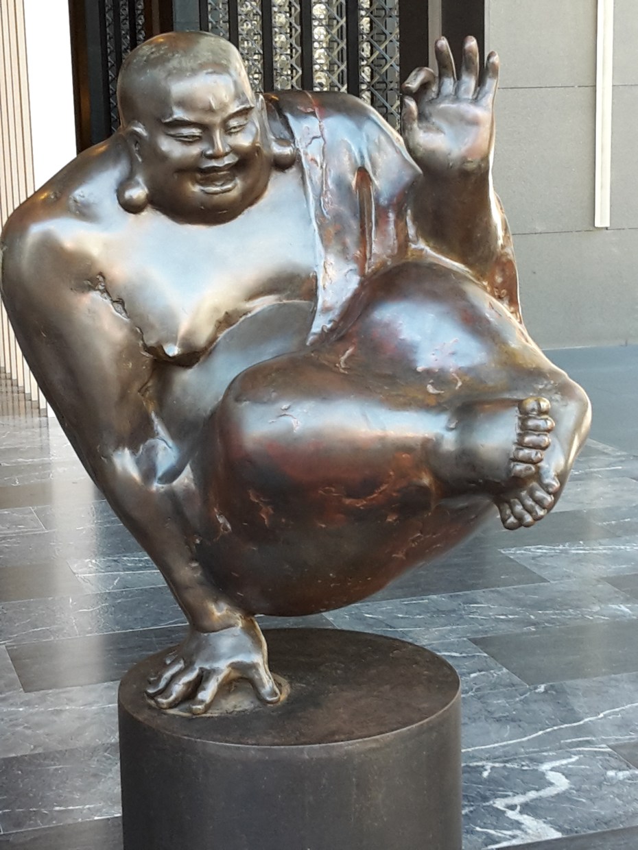
Nous avons fait le tour du pays et évité l’aéroport de Taipei, fermé de nombreuses heures pour cause d’inondations (bagages flottants, plus d’électricité), des quartiers de Tainan dans l’eau jusqu’aux genoux et déraillement de trains sur la côte est.
